From Geospatial Analytics for Urban Planning
Jump to navigation
Jump to search
|
|
| Line 13: |
Line 13: |
| | |} | | |} |
| | | | |
| − | [[File:Ex2 Map3 BinarySlope JeromeQuah.jpg|900px|thumb|center|'''Gombak Study Area with Binary Slope''']] | + | [[File:Ex2 Map3 BinarySlope JeromeQuah.jpg|900px|thumb|center|'''Gombak Study Area with Criterion Scores of:<br>- Economic Factor (Top Left)<br>- Health Risk Factor (Top Right)<br>- Natural Conservation Factor (Bottom Left)<br>- Accessibility Factor (Bottom Right)''']] |
| | | | |
| | <!-- Economic Factor Heading --> | | <!-- Economic Factor Heading --> |
Revision as of 02:05, 5 November 2019
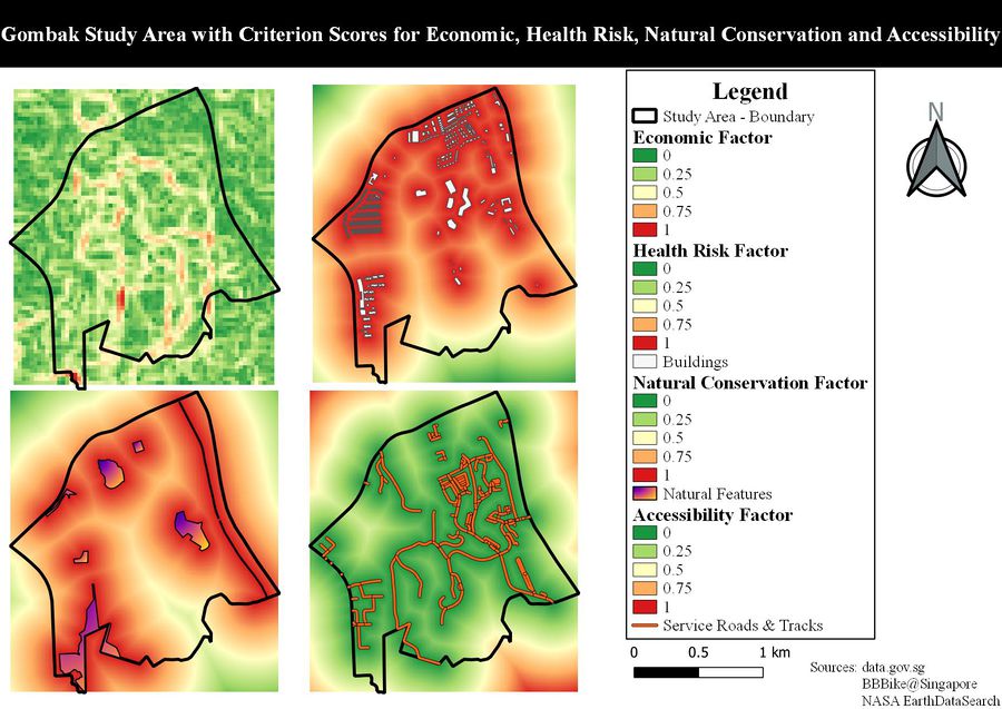
Gombak Study Area with Criterion Scores of:
- Economic Factor (Top Left)
- Health Risk Factor (Top Right)
- Natural Conservation Factor (Bottom Left)
- Accessibility Factor (Bottom Right)
| HEALTH RISK FACTOR (BUILDINGS)
|
| NATURAL CONSERVATION FACTOR (NATURAL FEATURES)
|
| ACCESSIBILITY FACTOR (ROADS)
|
