Difference between revisions of "IS428 AY2019-20T1 Assign Sean Chai Shong Hee Q3"
| Line 61: | Line 61: | ||
[[File:Travel path by sensor.png|700px|thumb|center|<center> Travel path of potentially contaminated cars </center>]] | [[File:Travel path by sensor.png|700px|thumb|center|<center> Travel path of potentially contaminated cars </center>]] | ||
| − | Of the 9 identified cars, only one has travelled across multiple neighbourhoods. As can be seen by the locality of the sensors, the other 8 sensors have only travelled within Wilson Forest ever since their contamination. | + | Of the 9 identified cars, only one (car fitted with sensor 46) has travelled across multiple neighbourhoods. As can be seen by the locality of the sensors, the other 8 sensors have only travelled within Wilson Forest ever since their contamination. |
=== Areas in need of additional monitoring infrastructure === | === Areas in need of additional monitoring infrastructure === | ||
Revision as of 18:06, 13 October 2019
This section will answer questions for Mini Case 2
Contents
Question 3
Reliability of sensors
The reliability of the sensors in locating areas of concerns depends on what we are trying to determine. If we are looking to determine if the readings are reliable in helping us determine background radiation levels, then contaminated sensors might give unreliable readings. However, if we are trying to determine areas where radioactive contamination might have spread to, data from contaminated sensors will be able to show us areas that are likely to be contaminated.
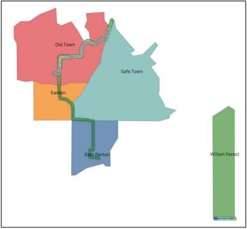
The map above shows areas where potentially contaminated cars have travelled to after contamination.
Contaminated cars are a cause for concern because they will spread the contamination to areas where they travel to. Officials should work on identifying these cars and isolate them.
Number of contaminated cars
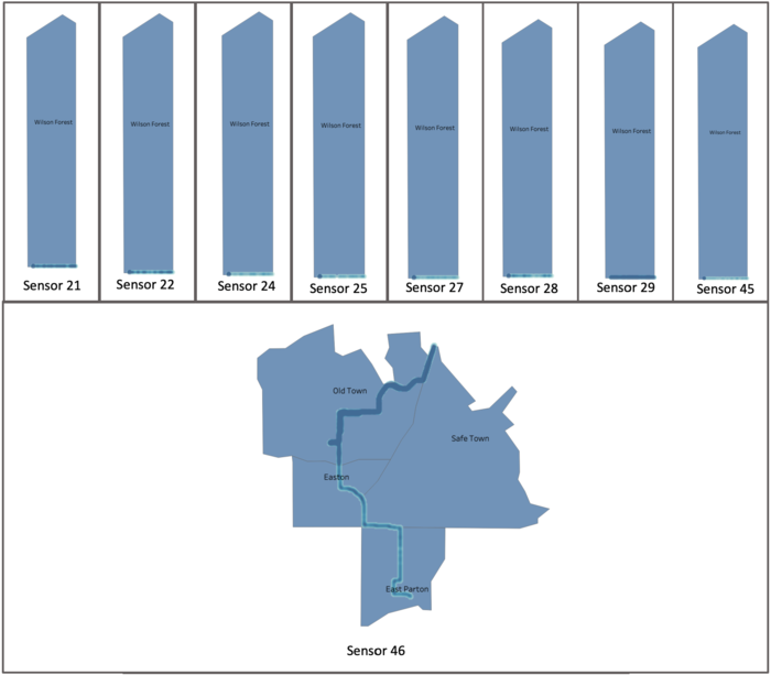
The estimated number of contaminated cars amount to 9. These cars will be cars in possession of the following sensors:
Of the 9 identified cars, only one (car fitted with sensor 46) has travelled across multiple neighbourhoods. As can be seen by the locality of the sensors, the other 8 sensors have only travelled within Wilson Forest ever since their contamination.
Areas in need of additional monitoring infrastructure
Areas in need of additional sensors are areas identified in Question 2. These areas include:
- Oak Willow
- Chapparel
- Wilson Forest
- Terrapin Springs
- Pepper Mill

