SMT201 AY2019-20T1 EX2 Ho Wei Jie Clint Suitability
TAKE HOME 2: National Communicable Disease Quarantine Centre - Gombak
Suitability Land Lots
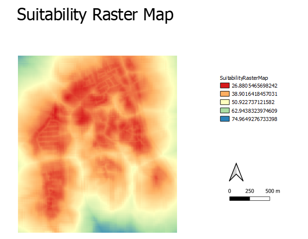
In order to obtain the suitable land lot for the National Communicable Disease Quarantine Centre – Gombak, I had to multiple the each of the respective criterion score of each factor layers by their respective weights. For example: (“Normalized_Roads_Inverted * 26.3) + (Normalized_Slope_Inverted * 5.7) + (Normalized_Buildings * 55.8) + (Normalized_Natural_Conservation * 12.2), obtaining my Suitability Raster Map as shown below.
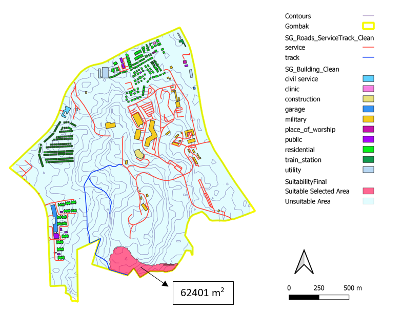
I then used Raster Analysis to Reclassify by Table to represent a binary of Suitable and Unsuitable. As shown in my legend portion of my Suitability Raster Map, I took anything above 55 as 1 (Suitable) and anything below 55 as 0 (Unsuitable). Through this, I obtained my FINAL suitability map as shown below.
My final suitability map meets the required requirement having the contiguous area to be at least 1000m^2. My suitable selected area is of an area size of 62401m^2. Next, my selected area is also away from buildings, which meets the most important factor of health. Additionally, my selected area is within proximity of roads, specifically tracks, which is ideal for accessibility. This implies easier transportation of building materials during the construction stage.

