SMT201 AY2019-20T1 EX2 Ho Wei Jie Clint Proximity
Revision as of 22:04, 9 November 2019 by Clint.ho.2018 (talk | contribs) (→Proximity to Target Roads)
TAKE HOME 2: National Communicable Disease Quarantine Centre - Gombak
Proximity to Target Roads
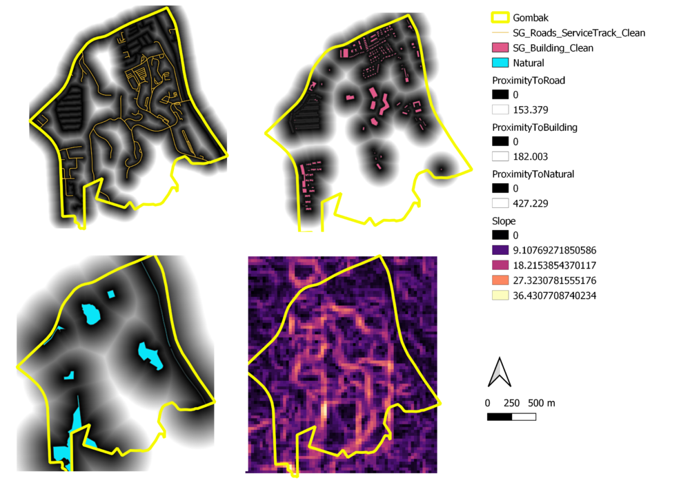
Shown in the top left picture. The dark regions (Black) represents the proximity, between 0 to 153.379m, to the roads and the lighter region (White) represents the distance of at least 153.379m away from the roads. It is observed that the Southern part represents a larger portion of lighter regions which implies that roads are at further away, by at least 153.379, potentially affecting the accessibility of the Southern part of Gombak.
