G2-Group03 Final Report
Introduction
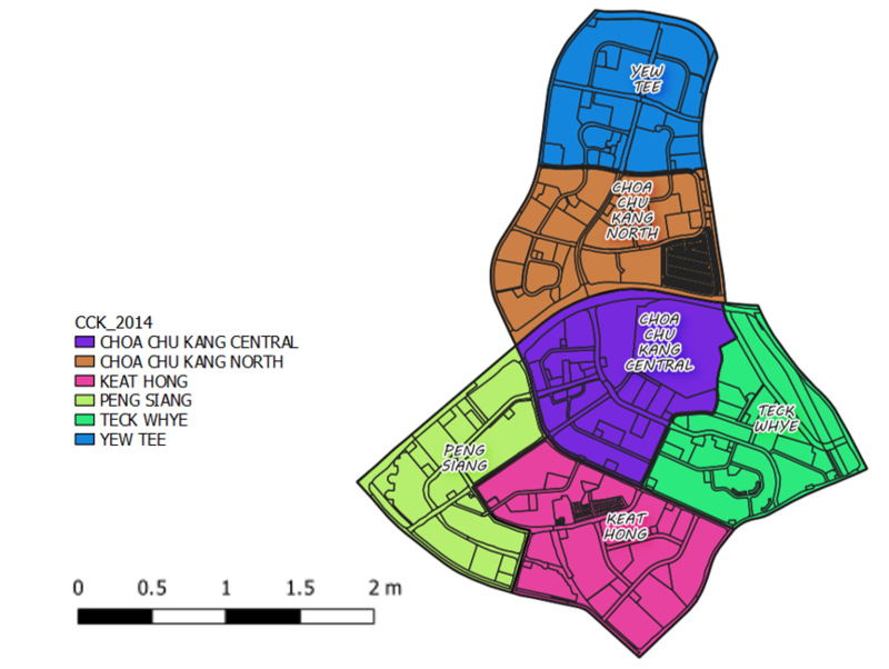
Choa Chu Kang is a planning area and residential town located at the north-westernmost point of the West Region of Singapore. The name "Choa Chu Kang" is derived from the Teochew word "kang chu". In the nineteenth century, Chinese immigrants to plant gambier and pepper along the river banks of Choa Chu Kang, although many migrated to Johor to the north at the encouragement of Temenggong, Johor. The plantation owners were known as Kangchu - the word "kang" refers to the riverbank and "chu" means "owner" or "master", referring to the headman in charge of the plantations in the area. "Choa" is the clan name of the first headman. Choa Chu Kang has a total area of 6.11 km2. As of the Master Plan 2014, Choa Chu Kang planning area is made up of 6 subzones: Choa Chu Kang Central, Choa Chu Kang North, Keat Hong, Peng Siang, Teck Whye and Yew Tee. It has a total population of 190,720 (as of June 2019) and population density of 31,265km2.
Objectives
1. Determine if current amenities and facilities will be able to meet the needs of the projected population of Choa Chu Kang in 2024, especially that of the infants (ages 0 to 4), working population (ages 25 to 64) and elderly (ages 65 and above). 2. Determine and select ideal locations in Choa Chu Kang for future amenities to be built to meet the needs of the aforementioned age groups

