SMT201 AY2019-20T1 EX2 Ho Wei Jie Clint Suitability
TAKE HOME 2: National Communicable Disease Quarantine Centre - Gombak
Suitability Land Lots
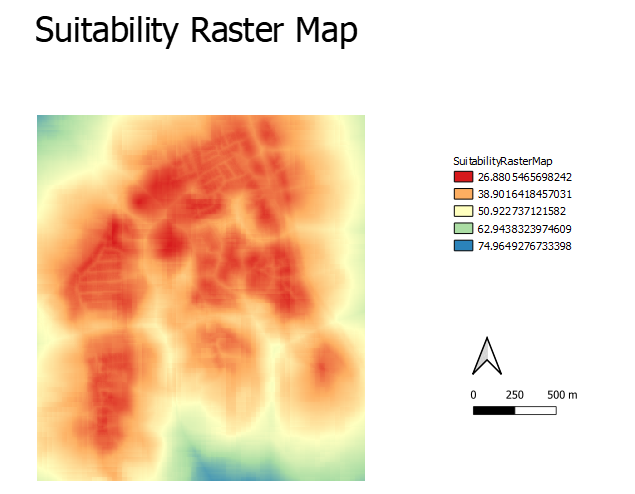
In order to obtain the suitable land lot for the National Communicable Disease Quarantine Centre – Gombak, I had to multiple the each of the respective criterion score of each factor layers by their respective weights. For example: (“Normalized_Roads_Inverted * 26.3) + (Normalized_Slope_Inverted * 5.7) + (Normalized_Buildings * 55.8) + (Normalized_Natural_Conservation * 12.2), obtaining my Suitability Raster Map as shown below.
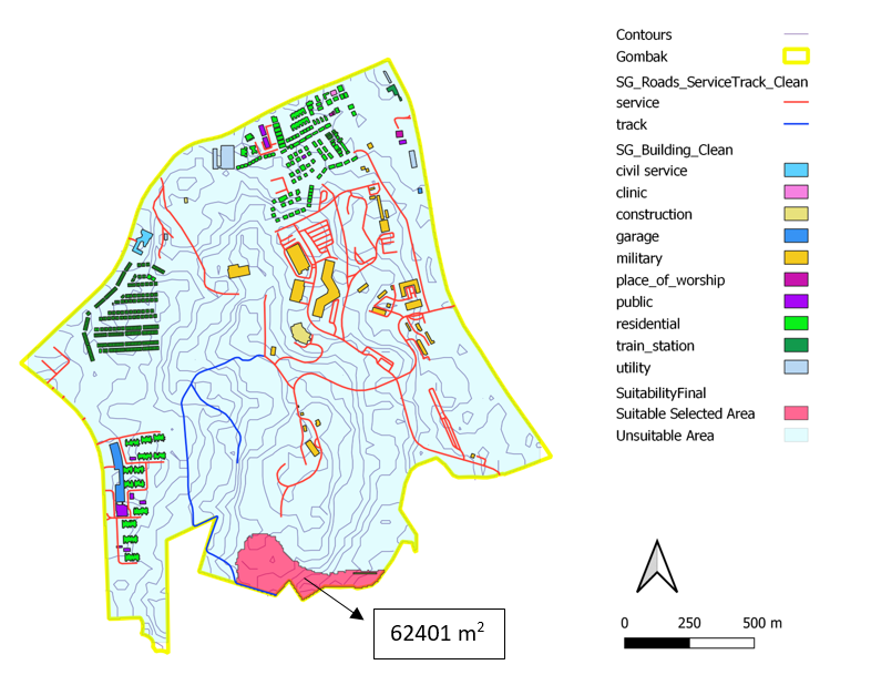
I then used Raster Analysis to Reclassify by Table to represent a binary of Suitable and Unsuitable. As shown in my legend portion of my Suitability Raster Map, I took anything above 55 as 1 (Suitable) and anything below 55 as 0 (Unsuitable). Through this, I obtained my FINAL suitability map as shown below.

