SMT201 AY2019-20G1 EX2 Tan Kin Meng
Revision as of 13:28, 9 November 2019 by Kinmeng.tan.2018 (talk | contribs) (→Target roads, Buildings, Target Natural Features and Digital Elevation)
Contents
- 1 Objective: Identify a location suitable for building a national Communicable Disease Quarantine Centre in Bukit Gombak (Singapore)
- 2 Target roads, Buildings, Target Natural Features and Digital Elevation
- 3 Proximity and slope
- 4 A map layout with four views showing the criterion scores of each factor layers and a short description of not more than 150 words for each view
- 4.1 Economic factor: The selected site should avoid steep slope. This is because construction at steep slope tends to involve a lot of cut-and-fill and will lend to relatively higher development cost
- 4.2 Accessibility factor: The selected site should be close to existing local roads, namely: service roads and tracks. This is to ensure easy transportation of building materials during the construction stage
- 4.3 Health risk factor: The selected site should be away from population i.e. housing areas and offices in order to avoid disease spreading to the nearby population
- 4.4 Natural conservation factor: The selected site should be away from forested land, park and water
- 5 Analytical Hierarchical Process (AHP) input matrix
- 6 Suitability land lot
Objective: Identify a location suitable for building a national Communicable Disease Quarantine Centre in Bukit Gombak (Singapore)
'
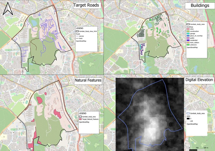
Target roads, Buildings, Target Natural Features and Digital Elevation
A short description of not more than 100 words for each view.
Target roads
Description
Buildings
Description
Target Natural Features
Description
Digital Elevation
Description
Proximity and slope
A short description of not more than 150 words for each view.
Proximity to target roads layer
[[File:[FILE_NAME]|900px|center|TITLE]]
Description
Proximity to buildings layer
Description
Proximity to target natural features layer
Description
The study area and slope layer
Description
A map layout with four views showing the criterion scores of each factor layers and a short description of not more than 150 words for each view
Economic factor: The selected site should avoid steep slope. This is because construction at steep slope tends to involve a lot of cut-and-fill and will lend to relatively higher development cost
Accessibility factor: The selected site should be close to existing local roads, namely: service roads and tracks. This is to ensure easy transportation of building materials during the construction stage
Health risk factor: The selected site should be away from population i.e. housing areas and offices in order to avoid disease spreading to the nearby population
Natural conservation factor: The selected site should be away from forested land, park and water
Analytical Hierarchical Process (AHP) input matrix
An Analytical Hierarchical Process input matrix and result report and a short description of not more than 150 words discussing the analysis results.
Suitability land lot
A map layout with the suitability land lot(s) and a short description of not more than 200 words commenting on each of the suitable land lot identified.
