File:Ex2 Map3 BinarySlope JeromeQuah.jpg
Revision as of 02:01, 4 November 2019 by Jerome.quah.2018 (talk | contribs)
Size of this preview: 800 × 566 pixels. Other resolutions: 320 × 226 pixels | 1,753 × 1,240 pixels.
Original file (1,753 × 1,240 pixels, file size: 265 KB, MIME type: image/jpeg)
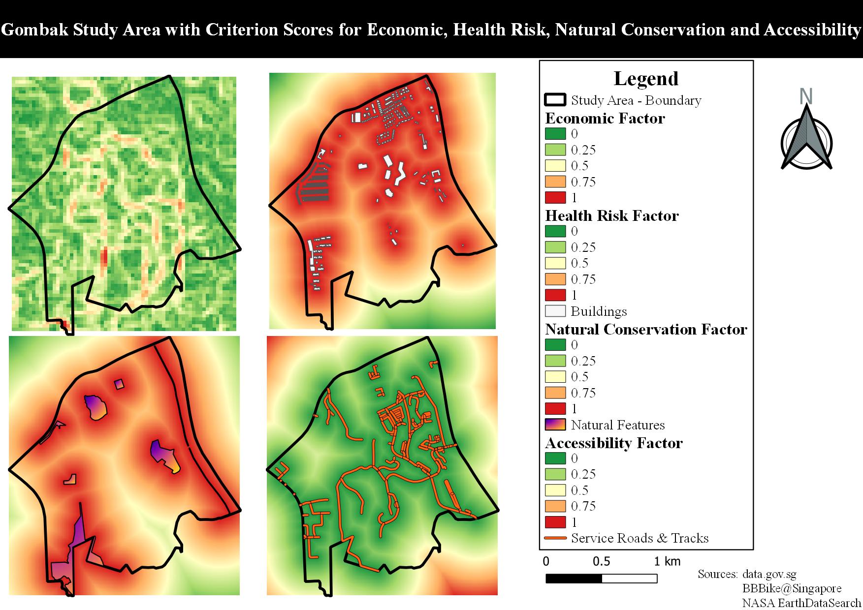
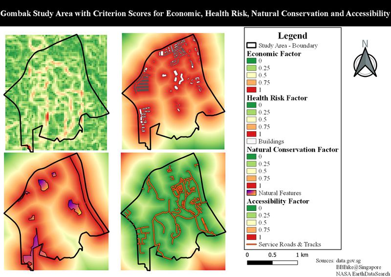
Gombak Study Area with Binary Slope as Criterion Score for Economic Factor
File history
Click on a date/time to view the file as it appeared at that time.
| Date/Time | Thumbnail | Dimensions | User | Comment | |
|---|---|---|---|---|---|
| current | 03:48, 8 November 2019 | | 1,753 × 1,240 (265 KB) | Jerome.quah.2018 (talk | contribs) | |
| 02:01, 5 November 2019 |  | 1,753 × 1,240 (285 KB) | Jerome.quah.2018 (talk | contribs) | ||
| 02:01, 4 November 2019 |  | 1,753 × 1,240 (156 KB) | Jerome.quah.2018 (talk | contribs) |
- You cannot overwrite this file.
File usage
The following page links to this file: