Difference between revisions of "SMT201 AY2019-20G2 Ex1 Lee Sean Jin"
Jump to navigation
Jump to search

| Line 1: | Line 1: | ||
== Part One: Thematic Mapping == | == Part One: Thematic Mapping == | ||
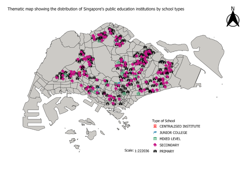
| − | === | + | === Distribution of Public Education Institutions in Singapore === |
[[File:Thematic map showing the distribution of public education institution by school types.png|800px|center|]] | [[File:Thematic map showing the distribution of public education institution by school types.png|800px|center|]] | ||
<br> | <br> | ||
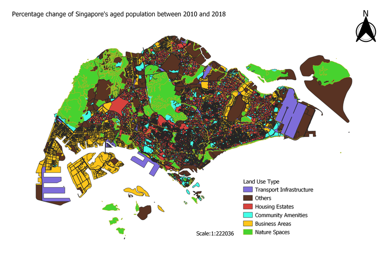
| − | === | + | === Singapore 2014 Master Plan Land Use === |
[[File:LandUse.png|800px|center]] | [[File:LandUse.png|800px|center]] | ||
<br> | <br> | ||
| − | === Road Network System === | + | === Singapore's Road Network System === |
[[File:Thematic map showing the hierarchy of road network system of Singapore.png|800px|center]] | [[File:Thematic map showing the hierarchy of road network system of Singapore.png|800px|center]] | ||
<br> | <br> | ||
Revision as of 23:06, 14 September 2019
Part One: Thematic Mapping
Distribution of Public Education Institutions in Singapore

Singapore 2014 Master Plan Land Use

Singapore's Road Network System
