Difference between revisions of "SMT201 AY2018-19T1 EX1 Ho Xin Yi"
Jump to navigation
Jump to search
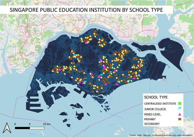
Singapore Public Educational Institution by School Type
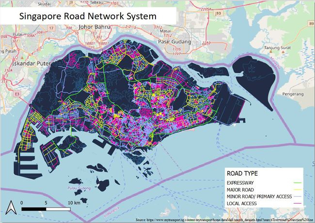
Singapore Road Network System
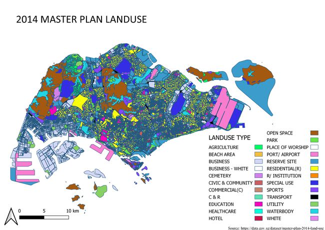
2014 Master Plan Landuse
| Line 2: | Line 2: | ||
=== Singapore Public Educational Institution by School Type <br><br> [[File:EducationBySchoolType.jpg|frameless|left|650px|Singapore public educational institution by school type]] <br><br> === | === Singapore Public Educational Institution by School Type <br><br> [[File:EducationBySchoolType.jpg|frameless|left|650px|Singapore public educational institution by school type]] <br><br> === | ||
| − | === Singapore Road Network System | + | === Singapore Road Network System <br><br> [[File:SingaporeRoadNetworkSystem.png|frameless|left|650px|Singapore Road Network System]] === |
| − | |||
| − | |||
| + | === 2014 Master Plan Landuse <br><br> [[File:2014MasterPlanLandUse.jpg|650px|frameless|left|2014 Master Plan Land Use]] === | ||
== Part 2: Choropleth Mapping == | == Part 2: Choropleth Mapping == | ||
Revision as of 22:31, 15 September 2019
Contents
Part 1: Thematic Mapping
Singapore Public Educational Institution by School Type

Singapore Road Network System

2014 Master Plan Landuse