Difference between revisions of "SMT201 AY2019-20G1 EX2 Lim Shi Xian Alvin"
Jump to navigation
Jump to search
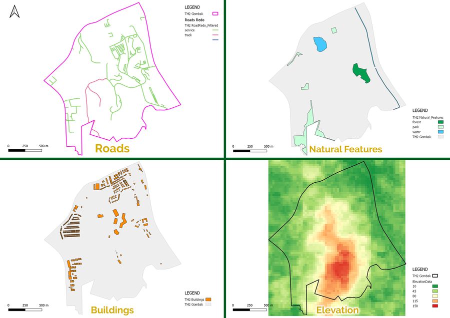
Data Source: Master Plan 2014 Subzone Boundary (No Sea) (SHP) from URA.[1]. Roads, Buildings and Natural (SHP) from OpenStreetMap.[2]. ASTER Global Digital Elevation Model (GDEM) dataset (TIFF) jointly prepared by NASA and METI, Japan; raster dataset combined by Professor Kam Tin Seong.[3].
| Line 10: | Line 10: | ||
[[File:Part1Combined.jpg|frameless|center|900px]] | [[File:Part1Combined.jpg|frameless|center|900px]] | ||
| + | |||
| + | <center>Data Source: Master Plan 2014 Subzone Boundary (No Sea) (SHP) from URA.[https://data.gov.sg/dataset/master-plan-2014-subzone-boundary-no-sea]. Roads, Buildings and Natural (SHP) from OpenStreetMap.[https://download.bbbike.org/osm/bbbike/Singapore/]. ASTER Global Digital Elevation Model (GDEM) dataset (TIFF) jointly prepared by NASA and METI, Japan; raster dataset combined by Professor Kam Tin Seong.[https://search.earthdata.nasa.gov/search?m=-7.175!25.59375!1!1!0!0%2C2].</center> | ||
Revision as of 17:08, 10 November 2019
Objective
The objective of this activity is to locate a suitable area to house the National Communicable Disease Centre. There are three criteria which the area would be subjected to. They are:
- Economic Factor
- Accessibility Factor
- Health Risk Factor
- Natural conservation factor
Inital Evaluation
