Difference between revisions of "SMT201 AY2019-20G1 EX1 Jessica Low Hui Chen"
Jump to navigation
Jump to search

| Line 22: | Line 22: | ||
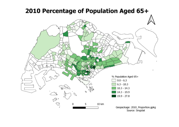
=== Proportion of Aged Population in 2010 === | === Proportion of Aged Population in 2010 === | ||
| + | [[File:2010 Proportion.png|600px|center|2010 Population Percentage Above 65]] | ||
| + | |||
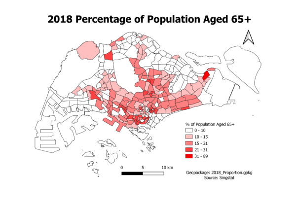
=== Proportion of Aged Population in 2018 === | === Proportion of Aged Population in 2018 === | ||
| − | + | [[File:2018 Proportion.png|600px|center|2018 Population Percentage Above 65]] | |
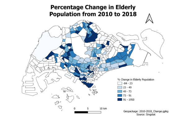
=== Percentage Change of Aged Population Between 2010 & 2018 === | === Percentage Change of Aged Population Between 2010 & 2018 === | ||
| + | [[File:2010 2018 Change.png|600px|center|Percentage Change of Population Above 65 Between 2010 & 2018]] | ||
Revision as of 23:19, 14 September 2019
Part One: Thematic Mapping
Distribution of Public Education Institutions by School Types
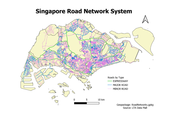
Hierarchy of Road Network System

2014 Master Plan Landuse

Part Two: Choropleth Mapping
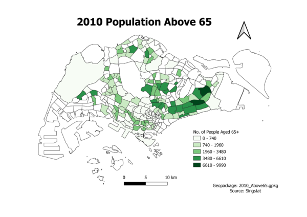
Aged Population (+65) in 2010

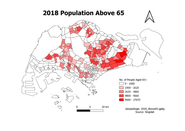
Aged Population (+65) in 2018

Proportion of Aged Population in 2010

Proportion of Aged Population in 2018

Percentage Change of Aged Population Between 2010 & 2018
