Difference between revisions of "SMT201 AY2018-19T1 EX1 Ho Xin Yi"
Jump to navigation
Jump to search
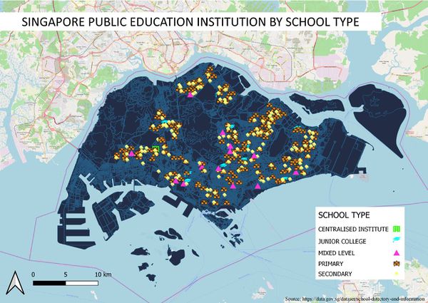
Singapore Public Educational Institution by School Type
Singapore Road Network System
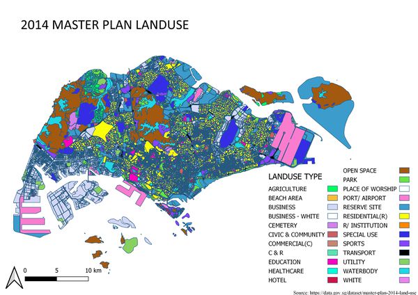
2014 Master Plan Landuse
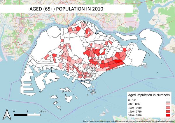
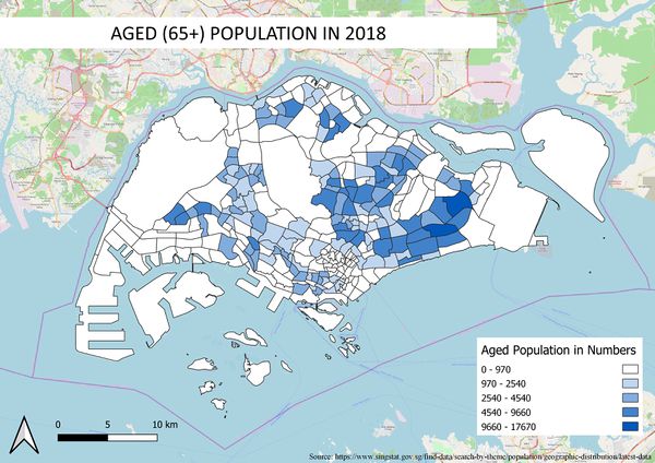
Aged population (+65) in 2010 and 2018
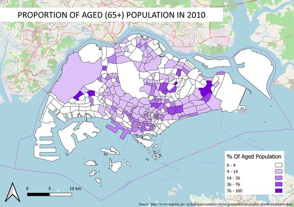
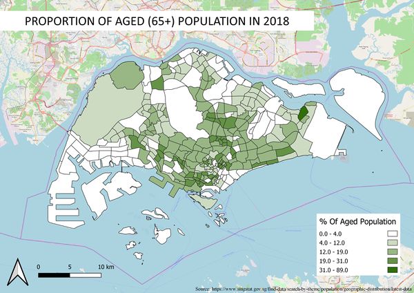
Proportional of aged population in 2010 and 2018
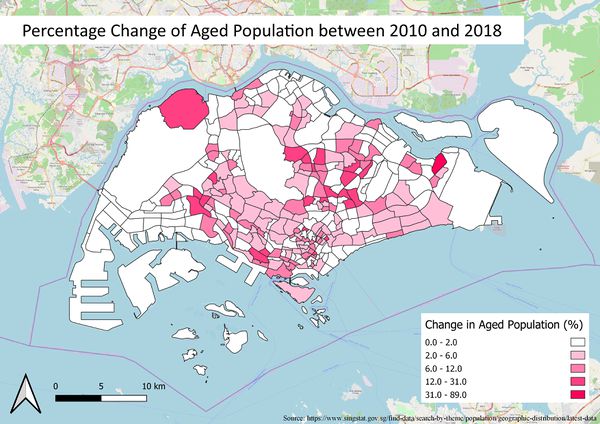
Percentage change of aged population between 2010 and 2018
| Line 11: | Line 11: | ||
=== Proportional of aged population in 2010 and 2018 <br><br> [[File:AgedProportion2010.jpg|600px|frameless|left|Proportional of aged population in 2010 and 2018]] [[File:AgedProportion2018.jpg|600px|frameless|center|Proportional of aged population in 2010 and 2018]] === | === Proportional of aged population in 2010 and 2018 <br><br> [[File:AgedProportion2010.jpg|600px|frameless|left|Proportional of aged population in 2010 and 2018]] [[File:AgedProportion2018.jpg|600px|frameless|center|Proportional of aged population in 2010 and 2018]] === | ||
| + | |||
| + | === Percentage change of aged population between 2010 and 2018 <br><br> [[File:PercentChange2010 2018.jpg|600px|frameless|left|Percentage change of aged population between 2010 and 2018.]] === | ||
Revision as of 22:41, 15 September 2019
Part 1: Thematic Mapping
Singapore Public Educational Institution by School Type

Singapore Road Network System


2014 Master Plan Landuse

Part 2: Choropleth Mapping
Aged population (+65) in 2010 and 2018


Proportional of aged population in 2010 and 2018


Percentage change of aged population between 2010 and 2018