Difference between revisions of "File:Road(1).png"
Jump to navigation
Jump to search
(No difference)
|
.png&oldid=2897)
.png&action=edit)
Latest revision as of 22:35, 15 September 2019
Lines makes the maps looks complicated. Hence I did not choose to use other patterned lines. Instead, I used different colored lines to specifically display Singapore’s road network system. The roads are categorised according to Singapore’s street suffixes. Because there are more local access roads and minor arterial/ primary access roads, I used lighter colors as compared to the other categories so that the other roads stands out as well.
File history
Click on a date/time to view the file as it appeared at that time.
| Date/Time | Thumbnail | Dimensions | User | Comment | |
|---|---|---|---|---|---|
| current | 22:35, 15 September 2019 | 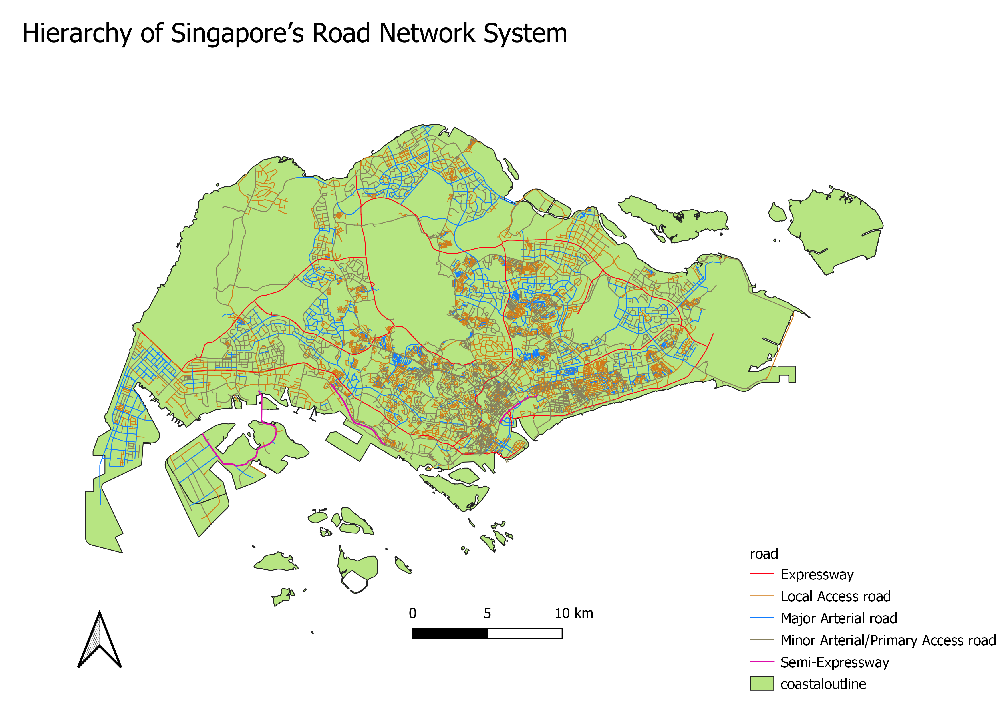 | 3,507 × 2,480 (1.88 MB) | Jingwen.tay.2018 (talk | contribs) |
- You cannot overwrite this file.
File usage
The following 2 pages link to this file:
.png&oldid=2897)
.png)
.png&action=edit&redlink=1)
.png&action=history)
.png)
.png)
.png&diff=2897&oldid=prev&printable=yes)
.png&action=info)