From Geospatial Analytics for Urban Planning
Jump to navigation
Jump to search
Project Motivation
|
With a size of 724 square kilometers, half that of London, Singapore is a city state with limited land space. As such, careful and stringent planning is needed to make the best use of current available planning areas. The Singapore population is forecasted to grow to 6.52 million in 2035. We must now ask if current infrastructure and facilities can support this increase in population which would exert pressures on homes, amenities and public spaces.
Furthermore, delving into each population group, specifically the young, working class and the aged we see the changes in existing and projected trends of each of these age groups. With changing needs, it is all the more integral that governmental bodies take the forefront and implement land use changes in accordance with these needs.
We will be utilizing data gathered from open sources to better understand the needs and plug in the necessary gaps, and after which providing suggestions for land use optimization. After careful evaluation of the 2008/2014 masterplan, this analysis aims to provide insights that the URA can draw on to better aid them in crafting a more comprehensive 2019 Master Plan.
|
Why Ang Mo Kio?
|
Ang Mo Kio is the 8th most populated planning area in the entire city state. Despite being a mature housing estate, one with more amenities and better accessibility, Ang Mo Kio still has immense potential for development. Situated in the North-East region of Singapore, Ang Mo Kio is home to an estimated 143,800 HDB residents, and has around 50,733 flats. Referring to and drawing valuable insights from the 2019 draft masterplan, we would then provide suggestions to better cater to the needs of the residents.
Ang Mo Kio has 12 planning subzones - Ang Mo Kio New Town, Cheng San, Chong Boon, Kebun Baru, Sembawang Hills, Shangri-La, Tagore, Towsville, Yio Chu Kang, Yio Chu Kang East, Yio Chu Kang North and Yio Chu Kang West.
|
Project Objective
|
In this analysis, we compared the 2008 and 2014 URA Masterplan - with a vision of an inclusive, liveable and economically vibrant city state. Through this we identified changes in landuse and would be proceeding to project changes to the 2019 Masterplan.
The basis on which the changes would be made would be based on the analysis of
A quantitative analysis : Projected population changes of the different age groups (Young, Economically Active, Elderly) which then means change in needs
A qualitative analysis: A deeper delve into the different areas (Green Spaces, amenities,transport, housing) to better cater to the residents needs
The project would do the following:
- Identify a planning area (Woodlands) and its subzones
- Collecting data from relevant sources (Data.gov, URA, LTA, HDB) to drive planning
- Geocode data on to QGIS and using GIS to determine the optimal location for a certain facility
|
Data
Infrastructure
Transport
Housing
Amenities and Facilities
Population
|
Scope of Work
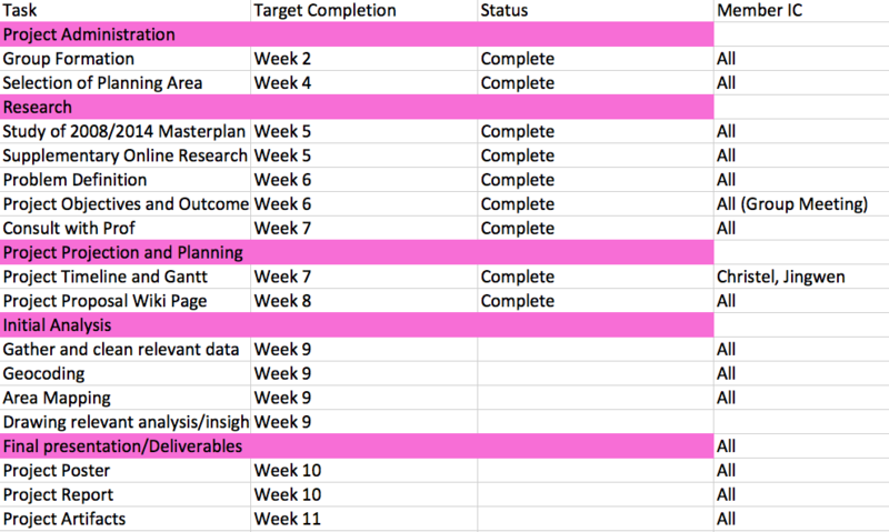
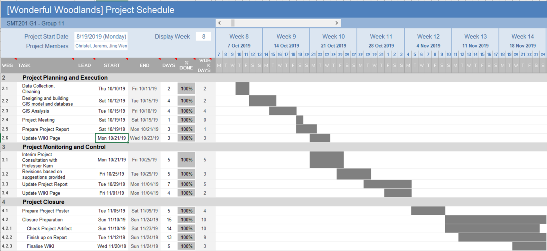
Project Schedule


