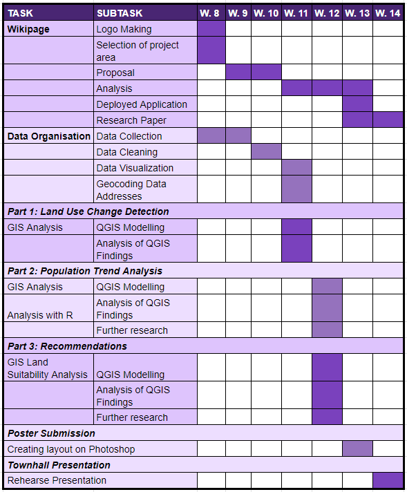
File:Gantt chart2.png
Jump to navigation
Jump to search

Size of this preview: 496 × 600 pixels. Other resolutions: 198 × 240 pixels | 589 × 712 pixels.
Original file (589 × 712 pixels, file size: 45 KB, MIME type: image/png)
Gantt chart2
File history
Click on a date/time to view the file as it appeared at that time.
| Date/Time | Thumbnail | Dimensions | User | Comment | |
|---|---|---|---|---|---|
| current | 00:42, 24 November 2019 | | 589 × 712 (45 KB) | Renatad.2018 (talk | contribs) |
- You cannot overwrite this file.
File usage
The following page links to this file: