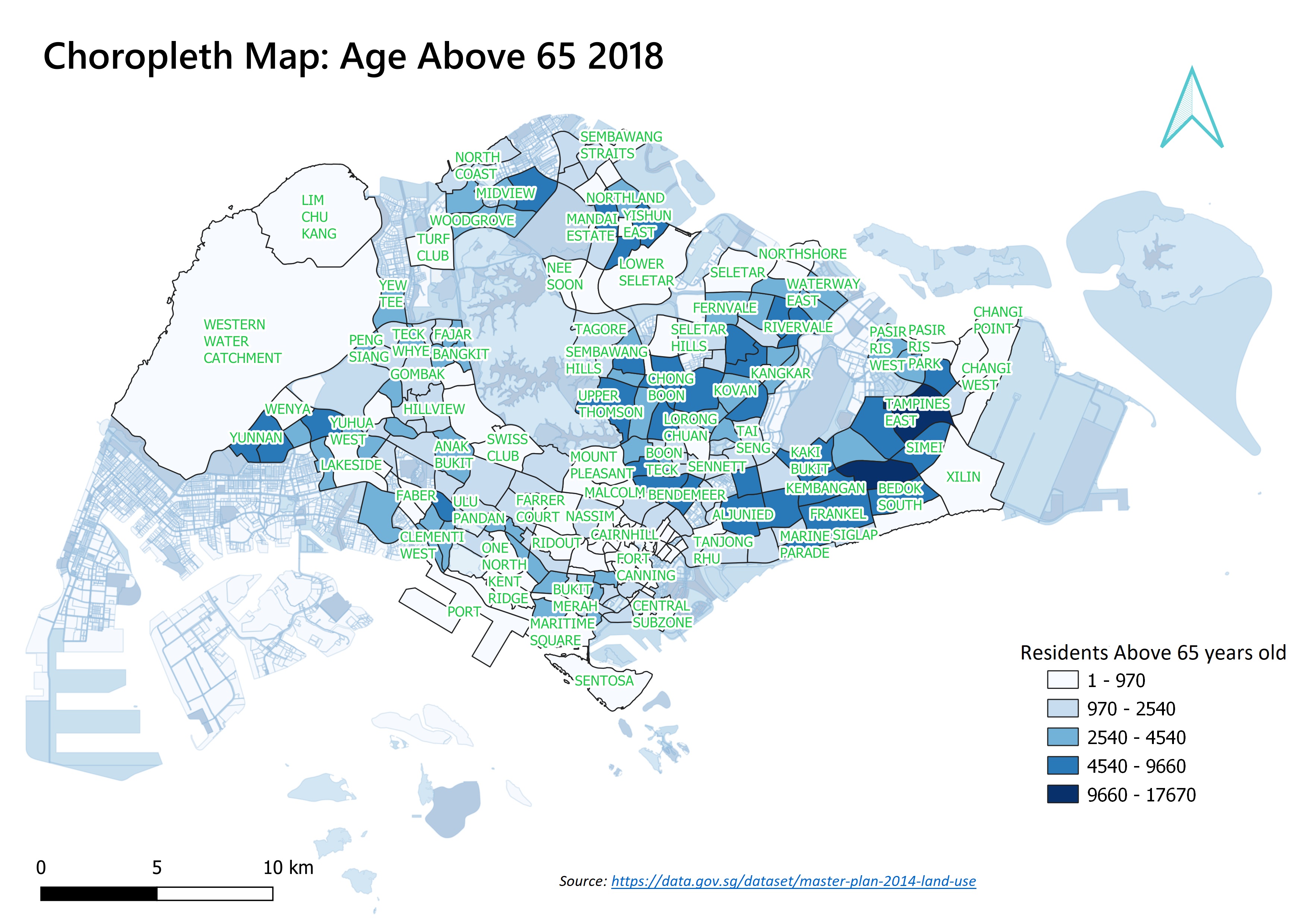
File:Choropleth Map Q1(2018).jpg
Jump to navigation
Jump to search

Size of this preview: 800 × 566 pixels. Other resolutions: 320 × 226 pixels | 3,507 × 2,480 pixels.
Original file (3,507 × 2,480 pixels, file size: 1.29 MB, MIME type: image/jpeg)
File history
Click on a date/time to view the file as it appeared at that time.
| Date/Time | Thumbnail | Dimensions | User | Comment | |
|---|---|---|---|---|---|
| current | 23:33, 15 September 2019 | | 3,507 × 2,480 (1.29 MB) | Timothy.lim.2018 (talk | contribs) |
- You cannot overwrite this file.
File usage
The following page links to this file:
.jpg&oldid=3277)
.jpg)
.jpg&action=edit&redlink=1)
.jpg&action=edit)
.jpg&action=history)
.jpg)
.jpg)
.jpg&printable=yes)
.jpg&oldid=3277)
.jpg&action=info)