Difference between revisions of "ISSS608 2017-18 T3 Assign Mu Fuyao"
| Line 92: | Line 92: | ||
'''2. For selected measures''' | '''2. For selected measures''' | ||
| − | [[File: Sample date.png| | + | I checked some reference book and selected some measures for common water quality tested. Not all measures are suitable for water quality testing. In research, I choose some organic chemicals and other chemicals for water pollution. Changes for these chemicals may lead to changing in pollutions. |
| + | |||
| + | [[File: Sample date.png| 800px]] | ||
We can see from this graph, most measures are in average range. But for iron, in 2003 quarter 3, it shows a extremely raising trend and made a peak for its trend. It influenced yearly trendy for iron. So, there must be some problems or uncommon events in Q3,2003 | We can see from this graph, most measures are in average range. But for iron, in 2003 quarter 3, it shows a extremely raising trend and made a peak for its trend. It influenced yearly trendy for iron. So, there must be some problems or uncommon events in Q3,2003 | ||
[[File: Year measure-trend.png|400px]] | [[File: Year measure-trend.png|400px]] | ||
Revision as of 19:08, 8 July 2018
|
|
|
|
|
Contents
Overview
Mini-Challenge 2 Overview
Last year, the Kasios Furniture Company was implicated in environmental damage to the Boonsong Lekagul Wildlife Preserve for both dumping toxic waste and polluting the air with chemicals from its manufacturing process. But Kasios is not taking these accusations lying down, and they deny any accusation of industrial waste dumping! Kasios’ spokespersons state that there isn’t any ground contamination near the remote ranger station that was suggested by last year’s mini-challenge 1 and 3 participants, and they have inspected that area and found it as pristine as the rest of the preserve.
Outraged ornithology professors from Mistford College journeyed out to look over the dumping site themselves and perform soil analyses. They returned to report that the site looked like there had been recent excavation and building activities going on. Boonsong Preserve rangers later confirmed that a new ranger station was being built at that site! Soil samples taken from the site were inconclusive in detecting Methylosmolene (the toxic manufacturing chemical in the suspected dumping) or any other contaminant, as new top soil had been trucked in.
With a primary piece of evidence against Kasios now gone, investigators will need to take another approach. Professors in the Mistford College Hydrology Department have come forward with several years of water sensor readings from rivers and streams in the preserve. These samples were taken from different locations scattered throughout the area and contain measurements of several chemicals of possible interest, but they have never been analyzed due to lack of funding. Could visual analytics help reveal something in this data that could make up for the soil evidence that was destroyed?
Task
My task is to investigate the hydrology data from across the Preserve. You are given a map of the Preserve (with the same base as last year’s challenge), with named sampling sites indicated on the map (the names have local significance, but are just mnemonics for your study) You are also provided with readings from each sampling station over time for several different chemicals and water properties.
Questions
1. Characterize the past and most recent situation with respect to chemical contamination in the Boonsong Lekagul waterways. Do you see any trends of possible interest in this investigation? Your submission for this questions should contain no more than 10 images and 1000 words.
2. What anomalies do you find in the waterway samples dataset? How do these affect your analysis of potential problems to the environment? Is the Hydrology Department collecting sufficient data to understand the comprehensive situation across the Preserve? What changes would you propose to make in the sampling approach to best understand the situation? Your submission for this question should contain no more than 6 images and 500 words.
3. After reviewing the data, do any of your findings cause particular concern for the Pipit or other wildlife? Would you suggest any changes in the sampling strategy to better understand the waterways situation in the Preserve? Your submission for this question should contain no more than 6 images and 500 words.
Data Preparation
Tools
1.JMP
Delete missing value and deal with repetitive data
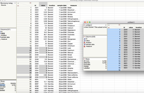
There are some measures having value of 0, I can’t decide whether the measurement is 0 or didn’t have measure. So, I regard it as missing value and delete.
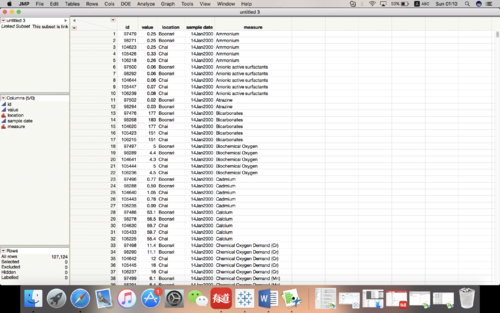
There are some strange values in this dataset. For same location, same time and same measure, but there are different values. I think it’s repetitive value. So, I get average of them.
Recode wrong data
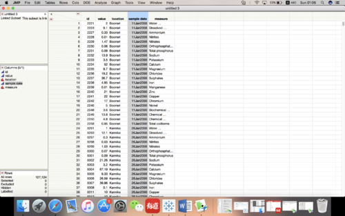
In JMP, it can’t recognize year before 2000. So, for year 1998 and 1999 it will show 2098 and 2099, I have to recode it by myself.
2.Tableau
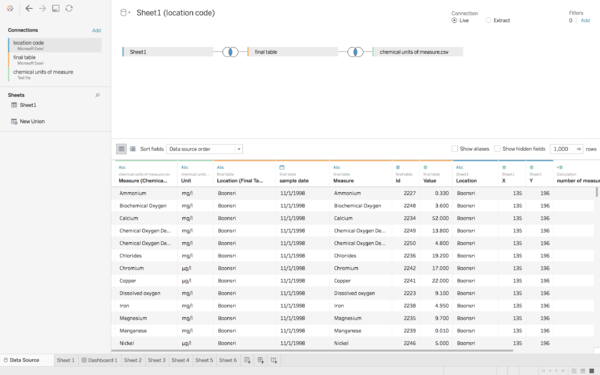
Draw graph and find patterns I use three different excel (csv) table in tableau, first I should combine them together then I can use them to draw graph
Analytical Results
Split Data
There are over hundred measures for our water quality testing. But not all of them are necessary for our research. Input all of the measures in my analysis will misleading results and have negative influences on parameters.
But for more accurate results, I have to make graphs for all measures first then choose some to make further research.
1. For all measures
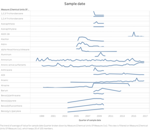
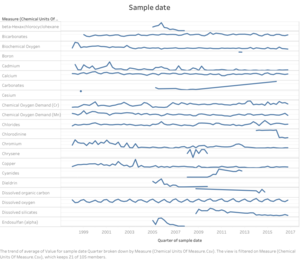
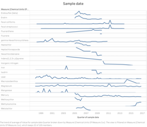
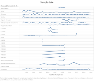
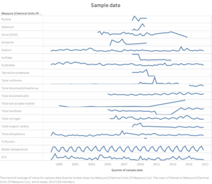
These five graphs show different measures' changes over the years. We can see changes for these measures are totally different. Some of them have no meaning for their patterns. But some do have seasonal patterns or year patterns.
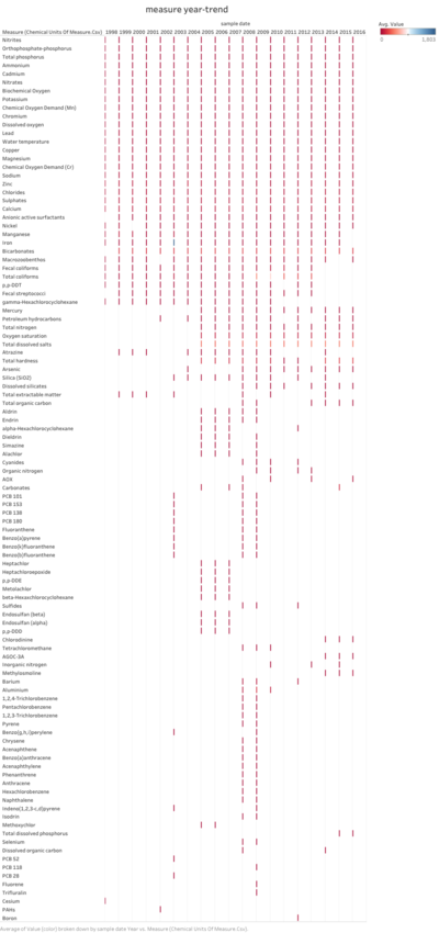
This graph show all measures year-trend from 1998-2016, we can see some measures were tested overs years and some were tested for one or two years. Which means that not all measures are tested in a year. For quality tester, they only choose some of them to test. And from this graph, we can see most measures were tested in 2008,2009 and 2014-2016.
2. For selected measures
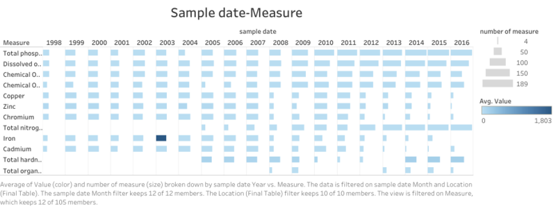
I checked some reference book and selected some measures for common water quality tested. Not all measures are suitable for water quality testing. In research, I choose some organic chemicals and other chemicals for water pollution. Changes for these chemicals may lead to changing in pollutions.
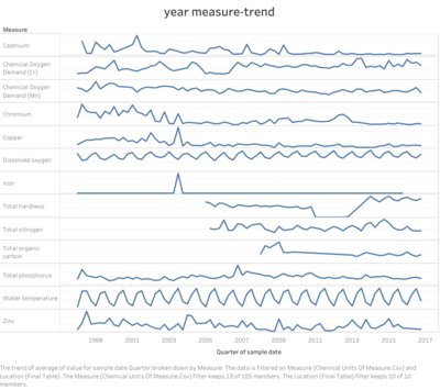
We can see from this graph, most measures are in average range. But for iron, in 2003 quarter 3, it shows a extremely raising trend and made a peak for its trend. It influenced yearly trendy for iron. So, there must be some problems or uncommon events in Q3,2003

