ISSS608 2016-17 T3 Assign SHUO ZHANG
Jump to navigation
Jump to search
Vast Mini-Challenge 3

|
|
|
|
|
Mini-Challenge 3 Overview
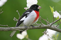
Multi-spectral image files of the Mistford are desired to be analyzed and visualized in order to uncover the reason of the decreasing the the Rose-crested Blue Pipit.
Please visit VAST Challenge 2017: Mini-Challenge 3 for more information and to download the data.
Questions
- Boonsong Lake resides within the preserve and has a length of about 3000 feet (see the Boonsong Lake image file). The image of Boonsong Lake is oriented north-south and is an RGB image (not six channels as in the supplied satellite data). Using the Boonsong Lake image as your guide, analyze and report on the scale and orientation of the supplied satellite images. How much area is covered by a pixel in these images? Please limit your answer to 3 images and 500 words.
- Identify features you can discern in the Preserve area as captured in the imagery. Focus on image features that you are reasonably confident that you can identify (e.g., a town full of houses may be identified with a high confidence level). Please limit your answer to 6 images and 500 words.
- There are most likely many features in the images that you cannot identify without additional information about the geography, human activity, and so on. Mitch is interested in changes that are occurring that may provide him with clues to the problems with the Pipit bird. Identify features that change over time in these images, using all channels of the images. Changes may be obvious or subtle, but try not to be distracted by easily explained phenomena like cloud cover. Please limit your answer to 6 images and 750 words.
Data
- CSV files:

- TIF files:

Tools
- QGIS
- Tableau
- R