File:Map2 klh.png
Jump to navigation
Jump to search

Size of this preview: 800 × 561 pixels. Other resolutions: 320 × 224 pixels | 1,116 × 782 pixels.
Original file (1,116 × 782 pixels, file size: 317 KB, MIME type: image/png)
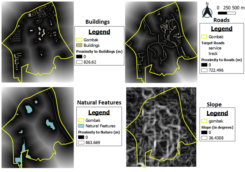
map layout 2
File history
Click on a date/time to view the file as it appeared at that time.
| Date/Time | Thumbnail | Dimensions | User | Comment | |
|---|---|---|---|---|---|
| current | 18:38, 6 November 2019 | | 1,116 × 782 (317 KB) | Lhkhong.2018 (talk | contribs) |
- You cannot overwrite this file.
File usage
There are no pages that use this file.