SMT201 AY2019-20T1 EX2 Zang Yu
Contents
Study Area
Roads (Accessibility Factor)
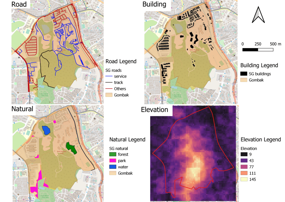
The roads are divided into service roads, tracks, and other type of roads. There are 2 tracks and 199 service roads in the data-set. From the map, we can see that the 2 tracks are located around the southern region of Gombak. Majority of the service roads are spread around the north-east region and minority of it are spread around west region. Therefore, eastern region of Gombak is the most accessible as it is closest to existing local roads.
Buildings (Health Risk Factor)
There are a lot of missing data in the "type" column of the data-set. Hence it is not meaningful to classify the buildings based on the building type. Most of the buildings are located around the boundary and very few of them located in the central. By looking at the map, it seems the southern region is more suitable to build the quarantine center as it is away from population.
Natural Features (Natural Conservation Factor)
Most of the natural features are located around the boundary of Gombak. The forest is located in the east region. The water bodies are located in both east and north regions. The parks are located in west and south-west regions of Gombak. Therefore, the central and south-east are more suitable to build the quarantine centre.
Elevation (Economic Factor)
The areas with lighter colors are steeper and most of it are located at the central region. The areas with darker color are flatter and more suitable for building the quarantine center.
Proximity analysis
Proximity to Roads (Accessibility Factor)
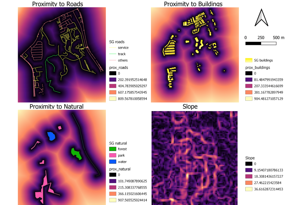
Darker color areas are regions that are nearer to the road. The selected site should be close to existing local roads. Therefore, the darker areas around the service roads or tracks are more suitable for building the quarantine center.
Proximity to Buildings (Health Risk Factor)
The area nearer to the building is darker and further away from the building is lighter. Since the selected site should be away from the population, the land lots with lighter color are more suitable for building the quarantine center.
Proximity to Natural Features (Natural Conservation Factor)
The land lots with lighter color are further away from the natural features. The selected site should be away from forested, park and water body. Therefore, land lots with lighter color are more suitable for building the quarantine center.
Proximity to Elevation (Economic Factor)
The land lots with darker color have flatter surface area. The maximum steepness is around 36.6 degrees. We should avoid steep slopes so darker areas are more suitable.
Criterion scores
I have used Min-Max criteria standardization techniques to standardize the score.
Criterion scores of Roads (Accessibility Factor)
Formula = (Proximity to roads- Min(Proximity to roads) / (Max(Proximity to roads)-Min(Proximity to roads))
Criterion scores of Buildings (Health Risk Factor)
Formula = (Proximity to building - Min(Proximity to building) / (Max(Proximity to building)-Min(Proximity to building))
Criterion scores of Natural Features (Natural Conservation Factor)
Formula = (Proximity to natural features- Min(Proximity to natural features) / (Max(Proximity to natural features)-Min(Proximity to natural features))
Criterion scores of Elevation (Economic Factor)
Formula = (Proximity to slope - Min(Proximity to slope ) / (Max(Proximity to slope )-Min(Proximity to slope ))
Analytical Hierarchical Process Input Matrix and Result Report
I have use pair-wise comparison method of AHP to show the relative importance of each factors. I have give health risk factor the highest
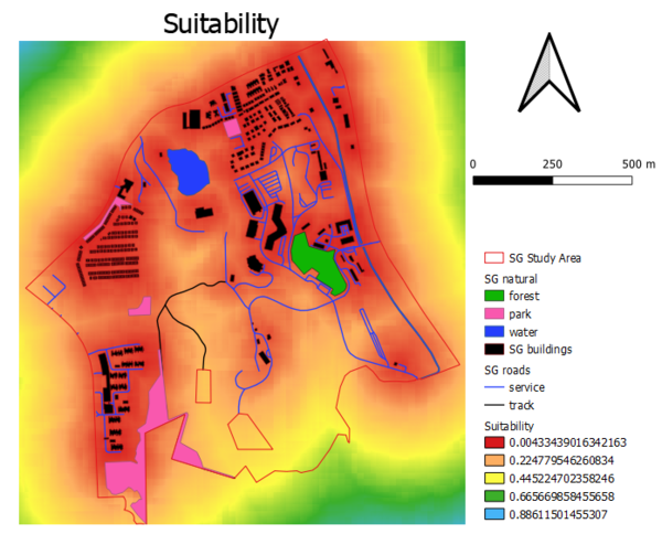
Suitability Land Lot(s)
Formula = ("Standardised buildings@1"*0.596)+("Standardised_natural@1"*0.204)+("Standardised_roads@1"*0.141)+("Standarised_slope@1"*0.059)


