File:Chosen area.png
Revision as of 16:31, 10 November 2019 by Kaelyn.kong.2018 (talk | contribs)
Error creating thumbnail: File with dimensions greater than 12.5 MP
Other resolution: 5,226 × 3,696 pixels.
Original file (5,226 × 3,696 pixels, file size: 1.35 MB, MIME type: image/png)
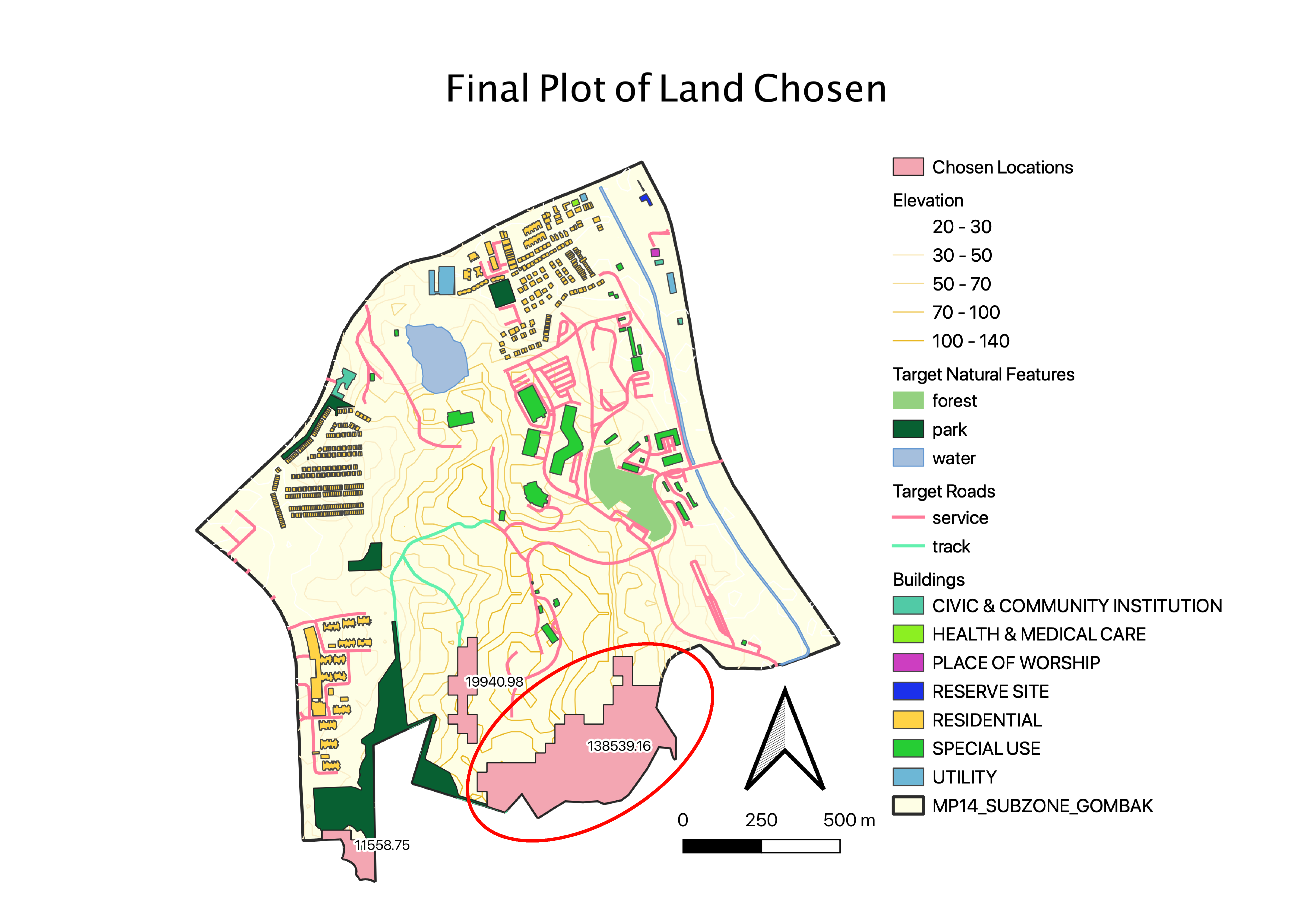
area of land chosen
File history
Click on a date/time to view the file as it appeared at that time.
| Date/Time | Thumbnail | Dimensions | User | Comment | |
|---|---|---|---|---|---|
| current | 16:31, 10 November 2019 | Error creating thumbnail: File with dimensions greater than 12.5 MP | 5,226 × 3,696 (1.35 MB) | Kaelyn.kong.2018 (talk | contribs) |
- You cannot overwrite this file.
File usage
There are no pages that use this file.