SMT201 AY2019-20T1 EX2 Zang Yu
Revision as of 13:35, 10 November 2019 by Yu.zang.2016 (talk | contribs) (→Roads (Accessibility Factor))
Contents
Study Area
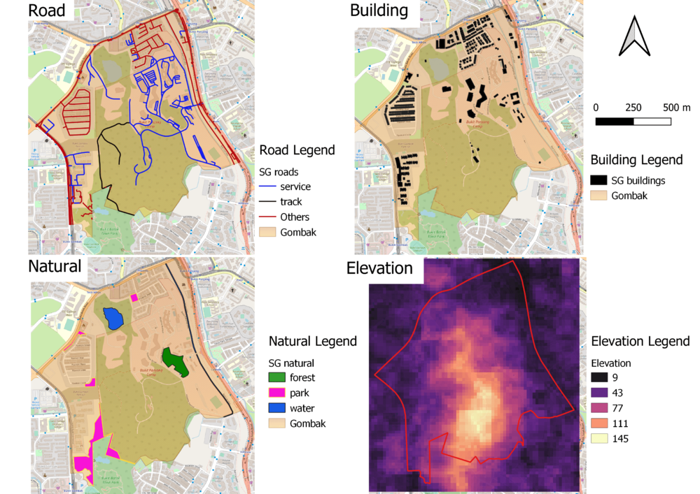
A map with four factors
Roads (Accessibility Factor)
The roads are divided into service roads, tracks, and other type of roads. There are 2 tracks and 199 service roads in the data-set. From the map, we can see that the 2 tracks are located around the southern region of Gombak. Majority of the service roads are spread around the north-east region and minority of it are spread around west region. Therefore, eastern region of Gombak is the most accessible as it is closest to existing local roads.
Buildings (Health Risk Factor)
Natural Features (Natural Conservation Factor)
Elevation (Economic Factor)
Proximity analysis
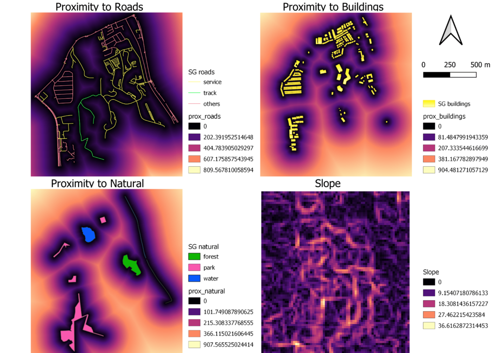
A map with four factors
- the study area and proximity to target roads layer,
- the study area and proximity to buildings layer,
- the study area and proximity to target natural features layer,
- the study area and slope layer

