SMT201 AY2019-20T1 EX2 Tan Wei Long Ryan
Contents
- 1 Project Objective
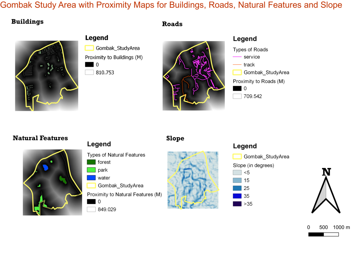
- 2 Part One : Map View with Study Area and Target Roads, Buildings, Natural Features, Digital Elevations Layer
- 3 Part Two: Proximity Map Layers
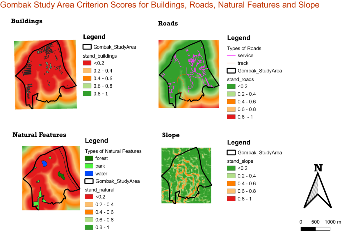
- 4 Part Three: Criterion Score of Factor Layers
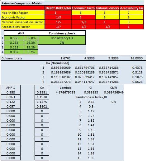
- 5 Part Four: Analytical Hierarchical Process Input Matrix & Result Report
- 6 Part Five: Suitability Land Lot
- 7 References and data sources
Project Objective
In this exercise, you are tasked to identify a location suitable for building a national Communicable Disease Quarantine Centre. The selected site must be located at Gombak planning subzone, with a contiguous area of at least 10,000m2 and it must meet the following decision factors:
Economic factor: The selected site should avoid steep slope. This is because construction at steep slope tends to involve a lot of cut-and-fill and will lend to relatively higher development cost.
Accessibility factor: The selected site should be close to existing local roads, namely: service roads and tracks. This is to ensure easy transportation of building materials during the construction stage.
Health risk factor: The selected site should be away from population i.e. housing areas and offices in order to avoid disease spreading to the nearby population.
Natural conservation factor: The selected site should be away from forested land, park and water.
Part One : Map View with Study Area and Target Roads, Buildings, Natural Features, Digital Elevations Layer
Buildings
Roads
Natural Features
Elevation


