File:Part1Mapping.png
Revision as of 23:49, 14 September 2019 by Eugene.choy.2016 (talk | contribs) (Eugene.choy.2016 uploaded a new version of File:Part1Mapping.png)
Size of this preview: 800 × 565 pixels. Other resolutions: 320 × 226 pixels | 1,169 × 826 pixels.
Original file (1,169 × 826 pixels, file size: 379 KB, MIME type: image/png)
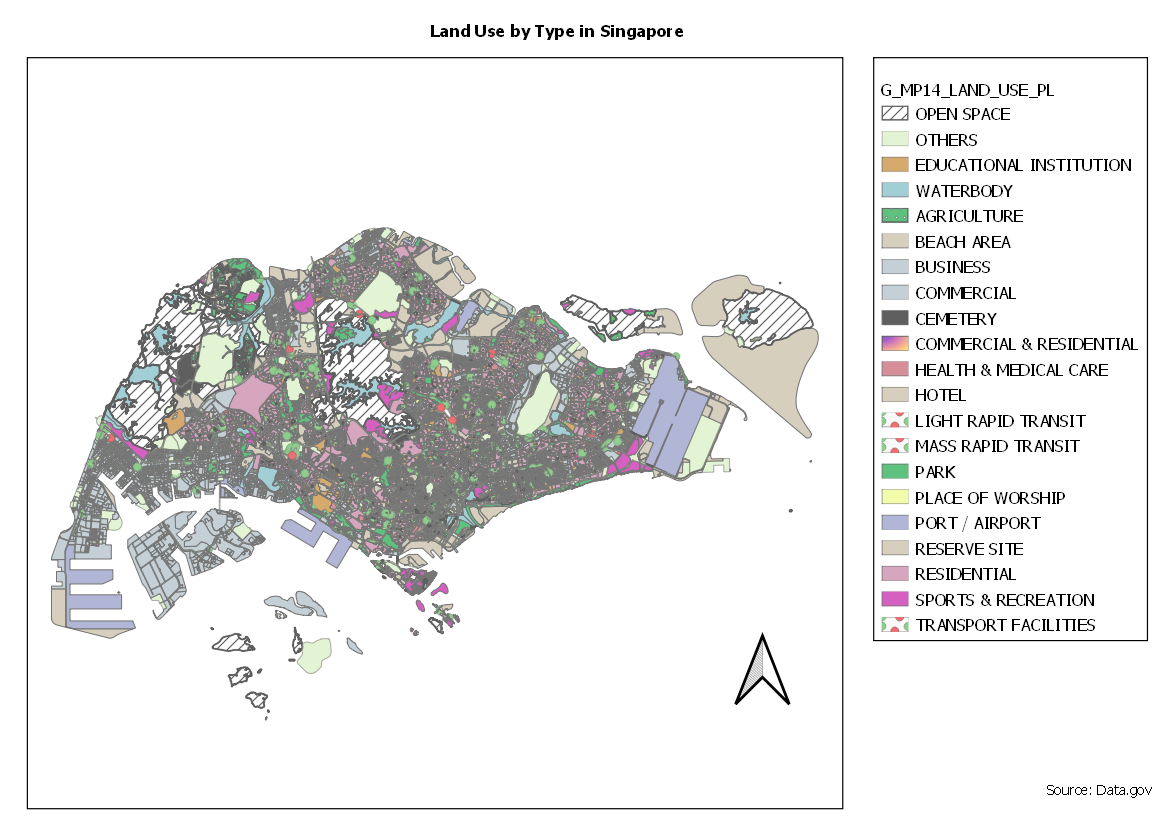
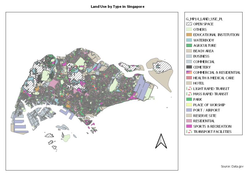
Thematic Map for 2014 Master Plan Landuse
File history
Click on a date/time to view the file as it appeared at that time.
| Date/Time | Thumbnail | Dimensions | User | Comment | |
|---|---|---|---|---|---|
| current | 23:49, 14 September 2019 | | 1,169 × 826 (379 KB) | Eugene.choy.2016 (talk | contribs) | |
| 13:14, 13 September 2019 |  | 1,169 × 826 (379 KB) | Eugene.choy.2016 (talk | contribs) | ||
| 12:52, 13 September 2019 |  | 841 × 595 (214 KB) | Eugene.choy.2016 (talk | contribs) |
- You cannot overwrite this file.
File usage
The following 2 pages link to this file: