SMT201 AY2019-20T1 EX2 Tan Jie Ting Christine
|
Overview |
Contents
Overview
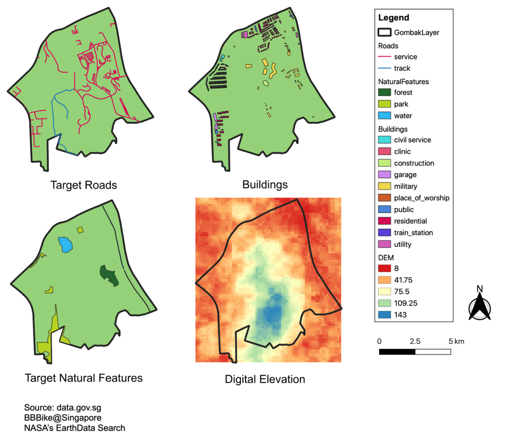
Take Home Exercise 2 aims to identify a location suitable to build a national Communicable Disease Quarantine Centre. The selected site must be located in the Gombak planning subzone, with a contiguous area of at least 10,000m2 and it must meet a set of decision factors, namely accessibility, health risk, natural conservation and economic.
Maps
Accessibility Factor
The accessibility factor is measured by the distance away from local roads, namely: service roads and tracks. The nearer it is to a local road, the more favourable the area. This is to ensure easy transportation of building materials during the construction stage. In the first view of the map above, we see the service roads and tracks, in pink and blue respectively.
Health Risk Factor
The health risk factor is measured by the distance away from buildings. The further it is away from buildings, the more favourable the area. This is to prevent diseases from spreading to the rest of the population.
Natural Conservation Factor
The natural conservation factor is measured by the distance away from nature. The further it is from natural features, the more favourable the area. The natural features we have identified in the Gombak subzone are forests, parks and water. The quarantined area should be kept far away from nature because natural features are normally used as recreational areas where people gather, and water can spread diseases easily. Also, it prevents us from contaminated our nature environment with diseases.
Economic Factor
The economic factor is measured by the degree of elevation of the area. The gentler the slope, the more favourable the area. Picking an area which is flatter is more favourable because it helps us to reduce the costs of construction. Constructing on a steep slope tends to involve a lot of cut-and-fill and will lend to relatively higher development cost. From the fourth view in the map above, we can see that the subzone of Gombak consists of a hill, with its peak at the blue area.
