SMT201 AY2019-20G1 Ex2 Kning Kit Siang
GIS Modelling for Urban Land Suitability Study
Contents
- 1 Target Roads, Buildings, Target Natural Features and Digital Elevation of Study Area (Gombak)
- 2 Proximity to Target Roads, Buildings and Natural Features with Slope Layer of Study Area (Gombak)
- 3 Criterion Scores of each factor layers
- 4 Analytical Hierarchical Process Input Matrix and Result Report
- 5 Suitability Land Lot(s)
- 6 Methods of Computation
Target Roads, Buildings, Target Natural Features and Digital Elevation of Study Area (Gombak)
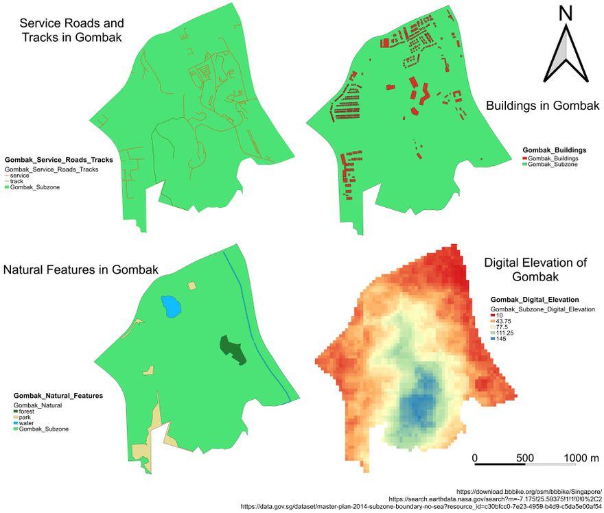
Service Roads and Tracks in Gombak
The view for service roads and tracks in Gombak shows the structure and location of the areas where the service roads and tracks are built in Gombak. As the accessibility factor only requires roads which are suitable to be utilised during the construction phase, only the service roads and tracks are chosen. The service roads are labelled with orange while the tracks are labelled with dark green to help in differentiating the two types of roads.
Buildings in Gombak
The view for buildings in Gombak shows the location of each building which are built within the Gombak subzone. The buildings in Gombak are not categorised because all buildings within the Gombak subzone is important to be considered for the health risk factor.
Natural Features in Gombak
The view for natural features in Gombak shows the location of the natural features which can be found within the Gombak subzone. There are three types of natural features found in Gombak; forest, park and water. As there are three types of natural features in Gombak, these natural features are categorised and labelled with different colours for better visualisation. In Gombak, there is a significant area of park and a few regions which contain water. There is also a small region near the centre of Gombak which is covered with forest.
Digital Elevation of Gombak
The view for digital elevation of Gombak shows the different level of elevation in different regions within the Gombak subzone. The centre of Gombak has the highest level of elevation compared to the other regions in Gombak. The level of elevation in Gombak is observed to be decreasing as it diverges from the centre of Gombak to the north region. The regions furthest from the centre of Gombak are observed to have the lowest level of elevation.
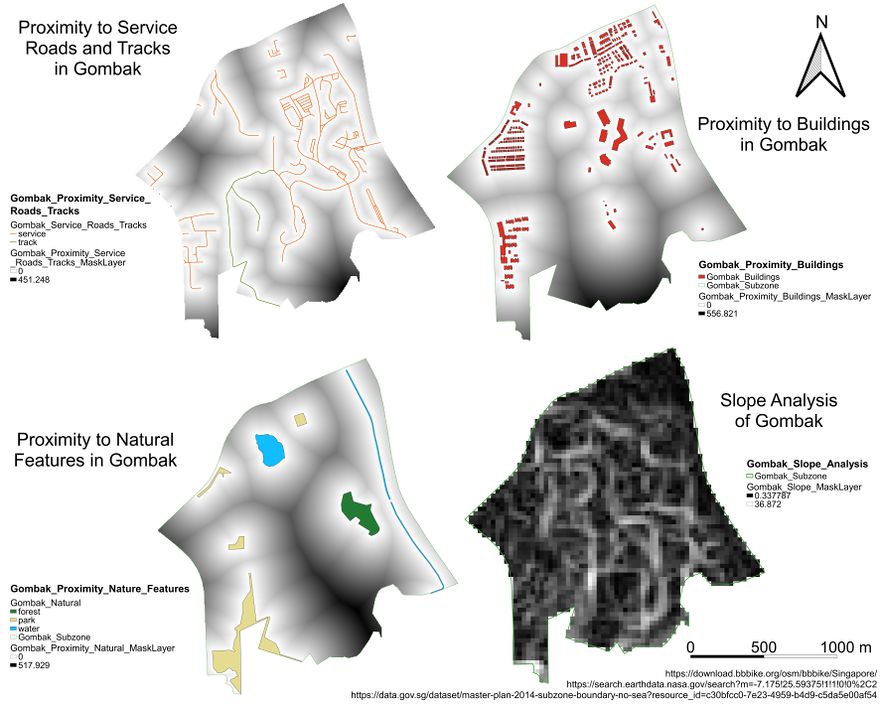
Proximity to Target Roads, Buildings and Natural Features with Slope Layer of Study Area (Gombak)
Criterion Scores of each factor layers
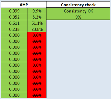
Analytical Hierarchical Process Input Matrix and Result Report
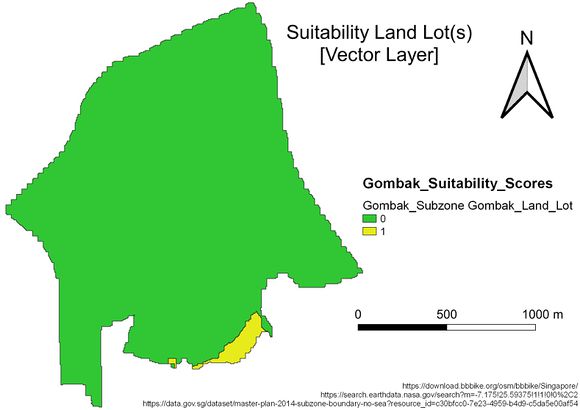
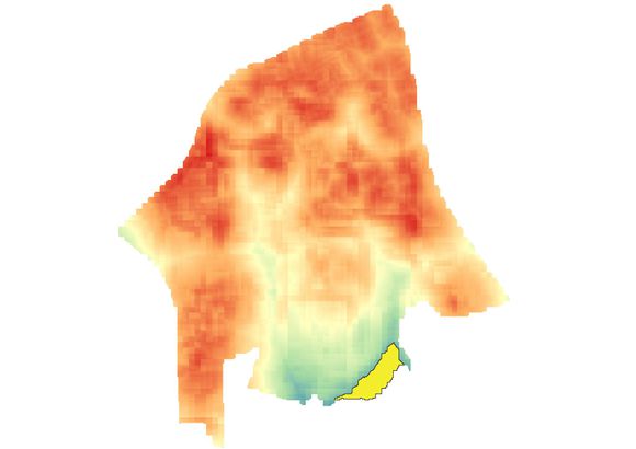
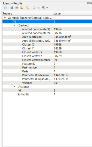
Suitability Land Lot(s)
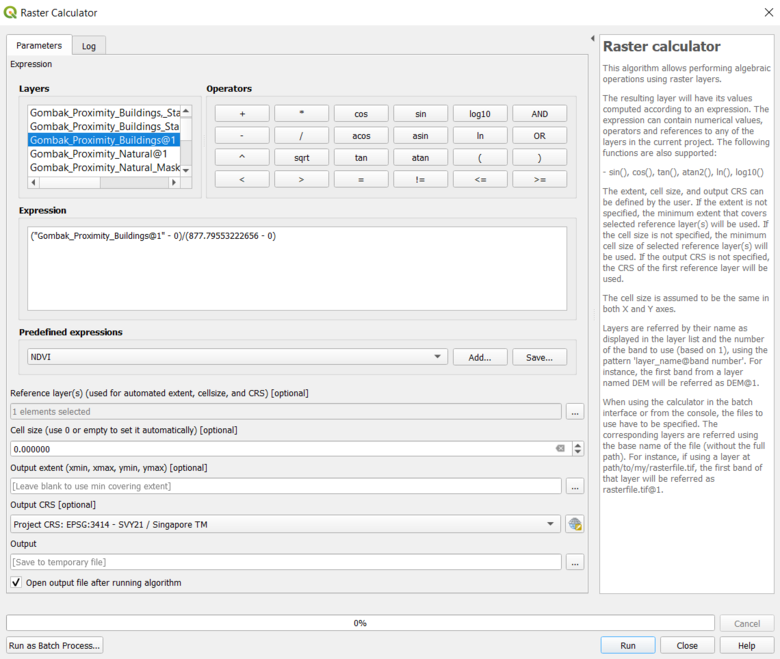
Methods of Computation
