SMT201 AY2019-20G2 Ex2 Lee Sean Jin
Objective
To identify a location suitable for building a National Communicable Disease Quarantine Centre. The selected site is located in the Gombak planning subzone, with a contiguous area of at least 10,000m2 and it must meet the following decision factors:
1. Economic factor: The selected site should avoid steep slope. This is because construction at steep slope tends to involve a lot of cut-and-fill and will lend to relatively higher development cost.
2. Accessibility factor: The selected site should be close to existing local roads, namely: service roads and tracks. This is to ensure easy transportation of building materials during the construction stage.
3. Health risk factor: The selected site should be away from population i.e. housing areas and offices in order to avoid disease spreading to the nearby population.
4. Natural conservation factor: The selected site should be away from forested land, park and water.
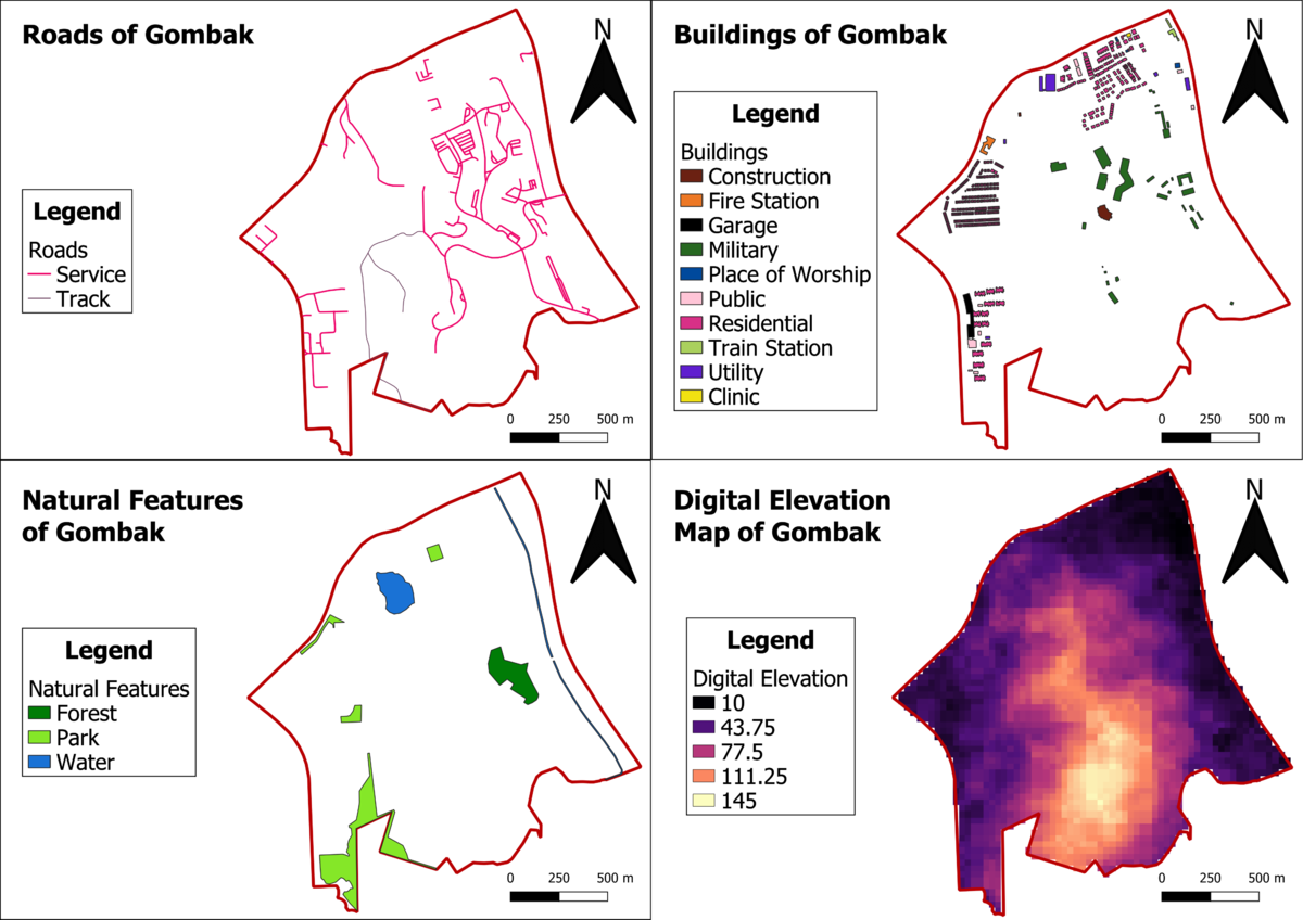
The main features of analysis as identified above will be as follows:
1. The Digital Elevation Map of Gombak.
2. Service roads and tracks in Gombak.
3. Buildings that has human traffic on a daily basis in Gombak.
4. Natural features containing forested land, parks and water bodies in Gombak.
Analysis of the features identified above

