File:Gombak Standardised Proximity.jpg
Revision as of 16:41, 9 November 2019 by Kskning.2018 (talk | contribs) (Kskning.2018 uploaded a new version of File:Gombak Standardised Proximity.jpg)
Size of this preview: 749 × 599 pixels. Other resolutions: 300 × 240 pixels | 7,086 × 5,669 pixels.
Original file (7,086 × 5,669 pixels, file size: 1.69 MB, MIME type: image/jpeg)
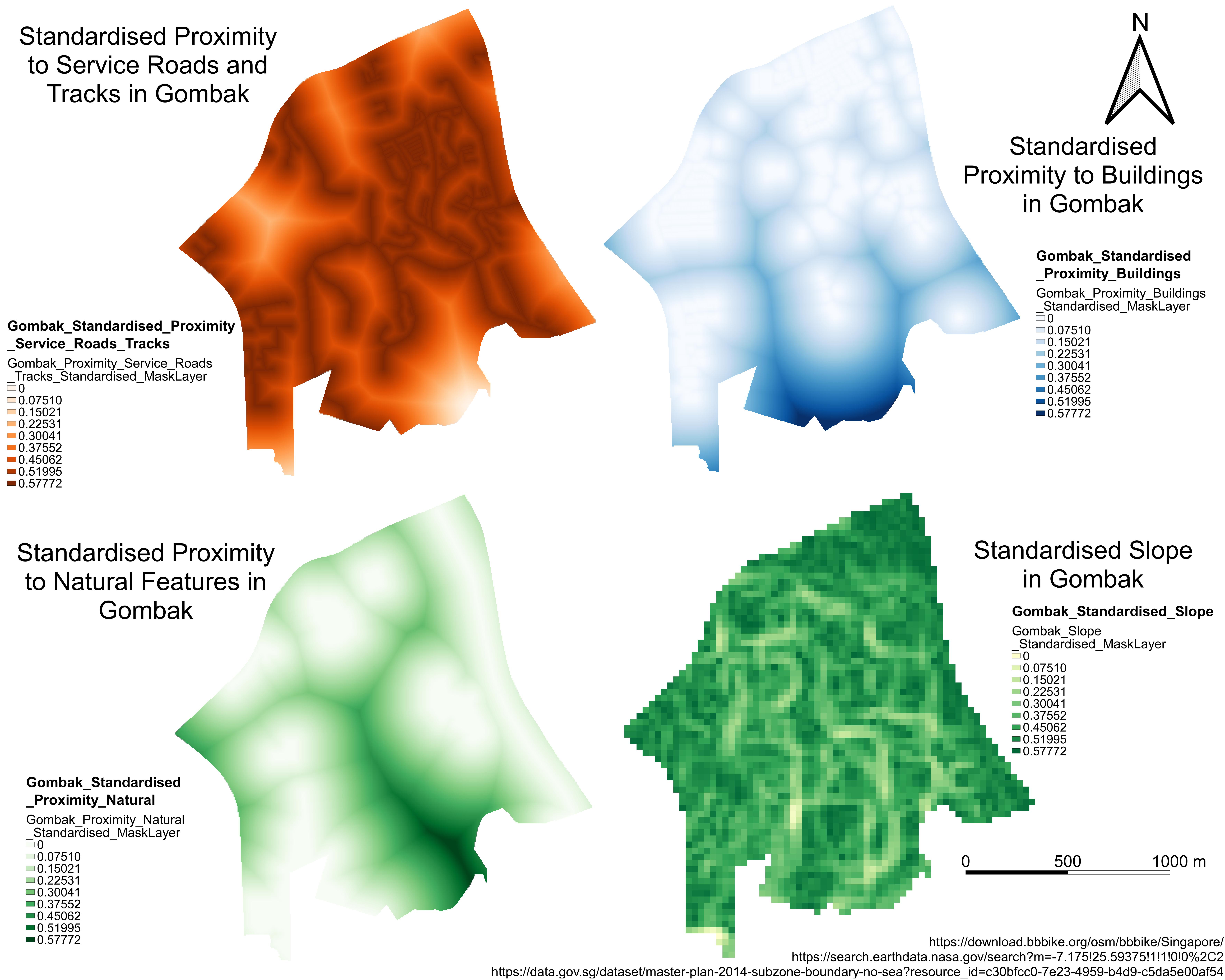
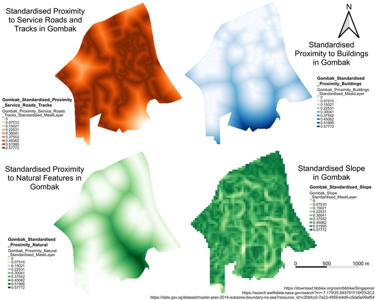
This is a map layout with four views of criterion scores of each factor layers.
File history
Click on a date/time to view the file as it appeared at that time.
| Date/Time | Thumbnail | Dimensions | User | Comment | |
|---|---|---|---|---|---|
| current | 21:17, 9 November 2019 | | 7,086 × 5,669 (1.69 MB) | Kskning.2018 (talk | contribs) | |
| 16:41, 9 November 2019 |  | 7,086 × 5,669 (1.7 MB) | Kskning.2018 (talk | contribs) | ||
| 20:55, 8 November 2019 |  | 7,086 × 5,669 (1.72 MB) | Kskning.2018 (talk | contribs) |
- You cannot overwrite this file.
File usage
The following page links to this file: