SMT201 AY2019-20T1 EX2 Tan Jie Ting Christine
|
Overview |
Contents
Overview
This Take Home Exercise aims to identify a location suitable for building a national Communicable Disease Quarantine Centre. The selected site must be located at Gombak planning subzone, with a contiguous area of at least 10,000m2 and it must meet a set of decision factors, namely economic, accessibility, health risk and natural conservation.
Maps
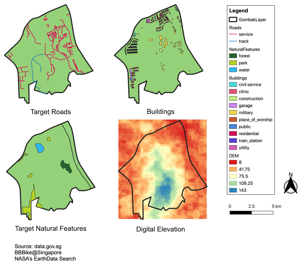
Target Roads
The selected site should be close to existing local roads, namely: service roads and tracks. This is to ensure easy transportation of building materials during the construction stage. In the first view,
Buildings
Target Natural Features
The selected site should be away from forested land, park and water. This is because nature are normally used as recreational areas where people gather, and water can spread diseases easily. In Bukit Gombak, there are only three forms of natural features, namely forest, parks and water.
