File:Area map.png
Revision as of 14:54, 8 November 2019 by Lhkhong.2018 (talk | contribs)
Size of this preview: 800 × 400 pixels. Other resolutions: 320 × 160 pixels | 995 × 497 pixels.
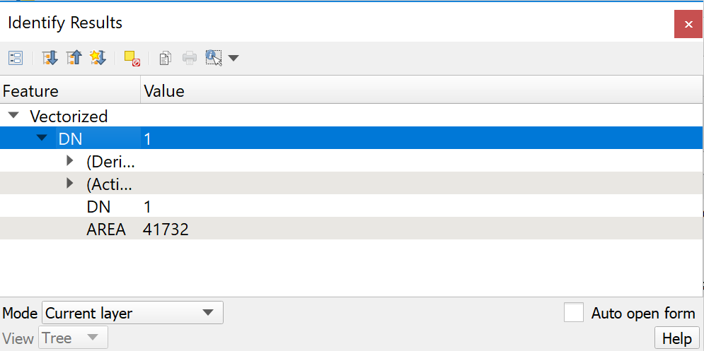
Original file (995 × 497 pixels, file size: 21 KB, MIME type: image/png)
-
File history
Click on a date/time to view the file as it appeared at that time.
| Date/Time | Thumbnail | Dimensions | User | Comment | |
|---|---|---|---|---|---|
| current | 14:54, 8 November 2019 | | 995 × 497 (21 KB) | Lhkhong.2018 (talk | contribs) |
- You cannot overwrite this file.
File usage
There are no pages that use this file.