File:Land Suitability Analysis - Total Score (out of 100%).jpg
Revision as of 10:54, 8 November 2019 by Yunyu.chong.2018 (talk | contribs) (Yunyu.chong.2018 uploaded a new version of File:Land Suitability Analysis - Total Score (out of 100%).jpg)
.jpg)
.jpg&diff=prev&oldid=7266)
.jpg&direction=prev&oldid=7266)
Size of this preview: 792 × 599 pixels. Other resolutions: 317 × 240 pixels | 2,332 × 1,765 pixels.
Original file (2,332 × 1,765 pixels, file size: 553 KB, MIME type: image/jpeg)
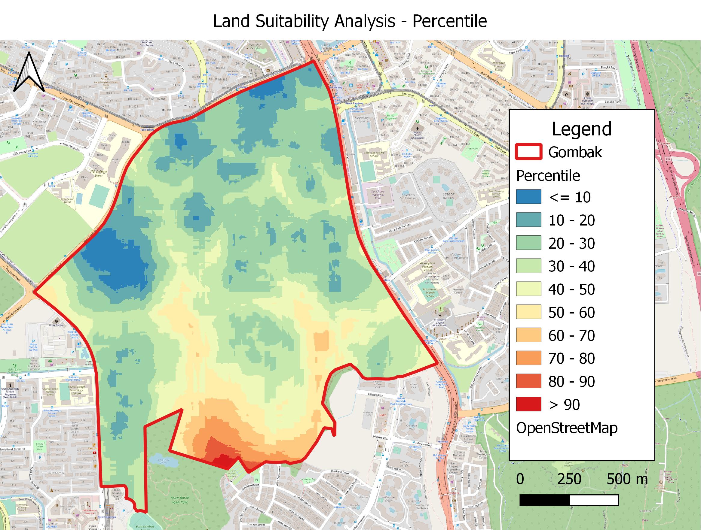
Discrete categories of score with 10 marks interval for each land lot
File history
Click on a date/time to view the file as it appeared at that time.
| Date/Time | Thumbnail | Dimensions | User | Comment | |
|---|---|---|---|---|---|
| current | 10:54, 8 November 2019 | | 2,332 × 1,765 (553 KB) | Yunyu.chong.2018 (talk | contribs) | |
| 14:31, 7 November 2019 |  | 2,835 × 2,082 (717 KB) | Yunyu.chong.2018 (talk | contribs) |
- You cannot overwrite this file.
File usage
The following page links to this file:
.jpg&oldid=7266)
.jpg&action=edit&redlink=1)
.jpg&action=edit)
.jpg&action=history)
.jpg)
.jpg)
.jpg&oldid=7266&printable=yes)
.jpg&oldid=7266)
.jpg&action=info)