File:Calculating Land Lot Suitability.jpg
Revision as of 10:33, 8 November 2019 by Yunyu.chong.2018 (talk | contribs) (Yunyu.chong.2018 uploaded a new version of File:Calculating Land Lot Suitability.jpg)
Size of this preview: 668 × 600 pixels. Other resolutions: 267 × 240 pixels | 1,105 × 992 pixels.
Original file (1,105 × 992 pixels, file size: 254 KB, MIME type: image/jpeg)
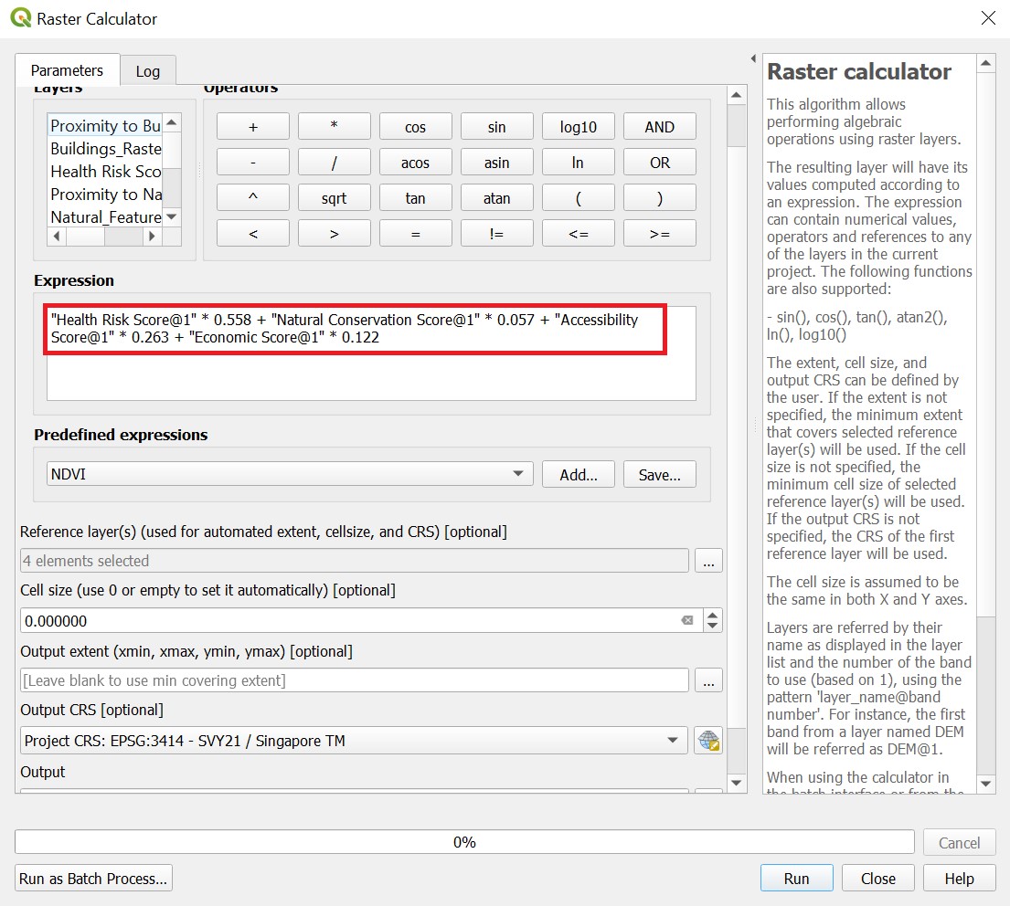
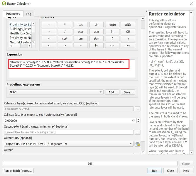
QGIS screenshot of how the land lot suitability is calculated
File history
Click on a date/time to view the file as it appeared at that time.
| Date/Time | Thumbnail | Dimensions | User | Comment | |
|---|---|---|---|---|---|
| current | 10:33, 8 November 2019 | | 1,105 × 992 (254 KB) | Yunyu.chong.2018 (talk | contribs) | |
| 14:25, 7 November 2019 |  | 1,108 × 995 (261 KB) | Yunyu.chong.2018 (talk | contribs) |
- You cannot overwrite this file.
File usage
The following page links to this file: