SMT201 AY2019-20G1 EX2 Eugene Choy Wen Jia
Contents
Objective
To identify a suitable location for building a National Communicable Disease Quarantine Centre.

Part One - Map Views w Roads, Buildings, Natural Areas and Elevation
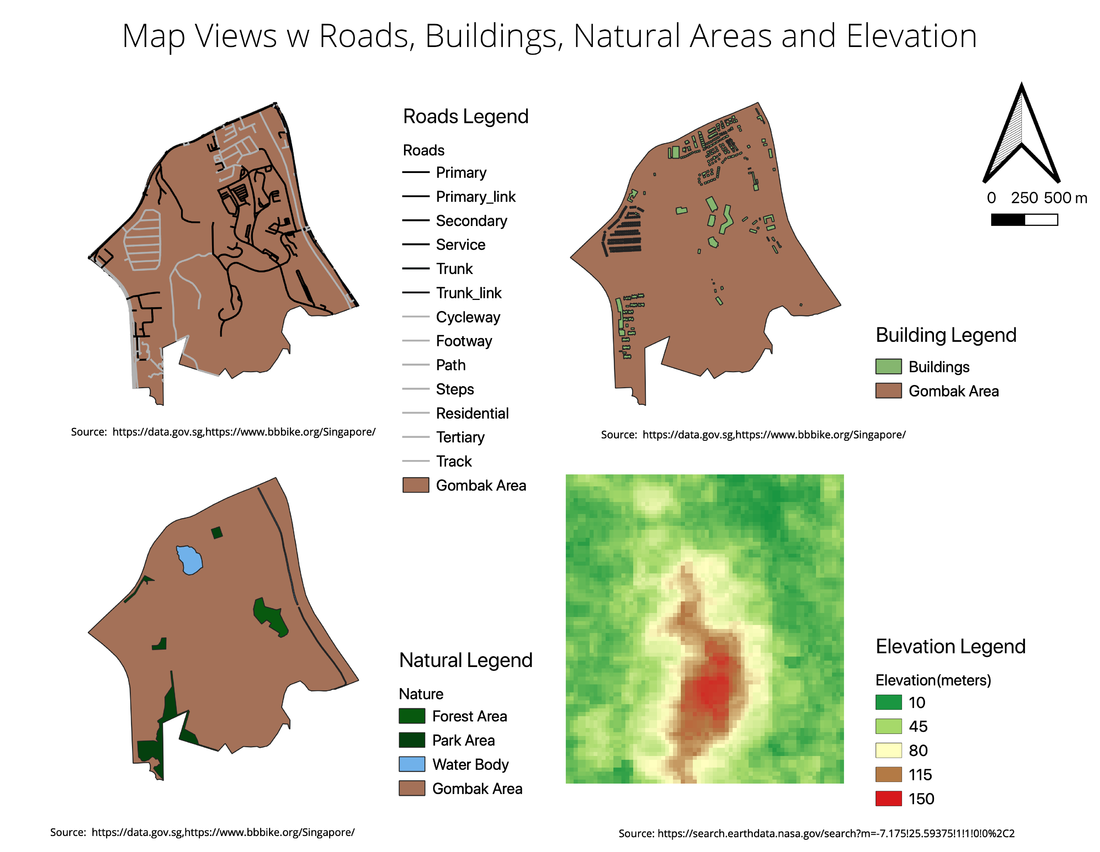
Map View w Roads
The road network in Gombak seems to be somewhat sparse as there are large areas which are not covered by roads. This will be a consideration as we are looking for suitable location that are accessible. However, the lack of road network could also suggest that there are large plot of area that might be available for our selection process. For the map view, I used black to represent the roads that can be used for transportation of materials to a suitable site. The grey roads represents paths/walkways or roads that leads to residential area which will not be used for this study. This could be part of consideration used when doing proximity analysis as it may not be suitable to include this residential related paths/roads into the the analysis for suitable site.
Map View w Buildings
The Buildings in Gombak is also somewhat sparse which means that are large area of land that are available for us to pick from as suggested previously by the sparse road network in Gombak. Most of the buildings in Gombak seem to be concentrated near the perimeter of the Gombak area.
Map View w Natural Areas
There are also some Natural Area features found in the Gombak Area. There are some forest and park area represented in dark green as well as water bodies represented in blue in this area. They are located near to the perimeter of the Gombak Area. However most of the natural areas seem to be near already existing buildings so it probably will not play a very huge part in the selection of area.
Raster w Elevation
The raster is represented with green being the low-lying land, yellowish to be medium elevated land and red being land that are elevated at the highest. From the raster map, it seems like the center of Gombak is the most elevated part, which probably is the reason why that area seem to be the least populated with road networks or even buildings.
Part Two
References
The Colors on Map - https://www.thoughtco.com/colors-on-maps-1435690ra
Photo by Thad Zajdowic from https://freeimages.com/
