SMT201 AY2019-20T1 EX1 Eugene Choy Wen Jia
Contents
Part One
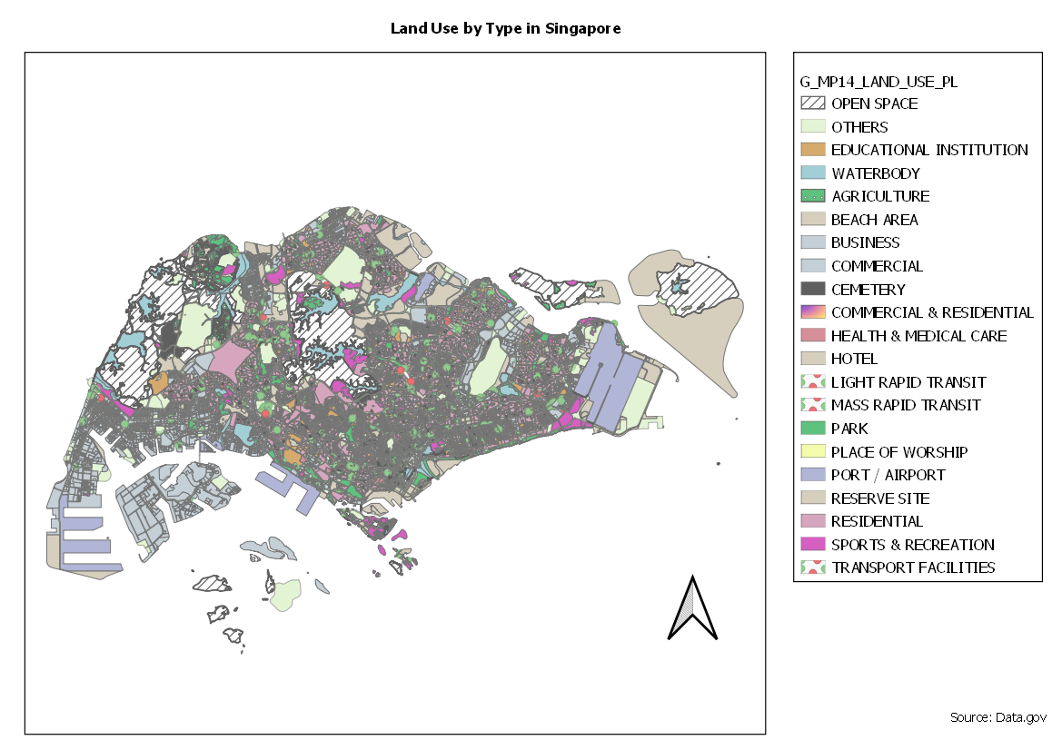
2014 Master Plan Landuse
Categorized Symbology was used to show a visual representation of the various different usage of land in Singapore. Similar categories were grouped together (Business, Business 1, Business Park) to avoid displaying too many colors which may be confusing and difficult to understand. A pattern with lines is used on Open Space to show that the spaces were not planned for any specific kind of development. This clear distinct visualization makes it easier for user potential user who plans for Land Use to know that this space is opened for planning.
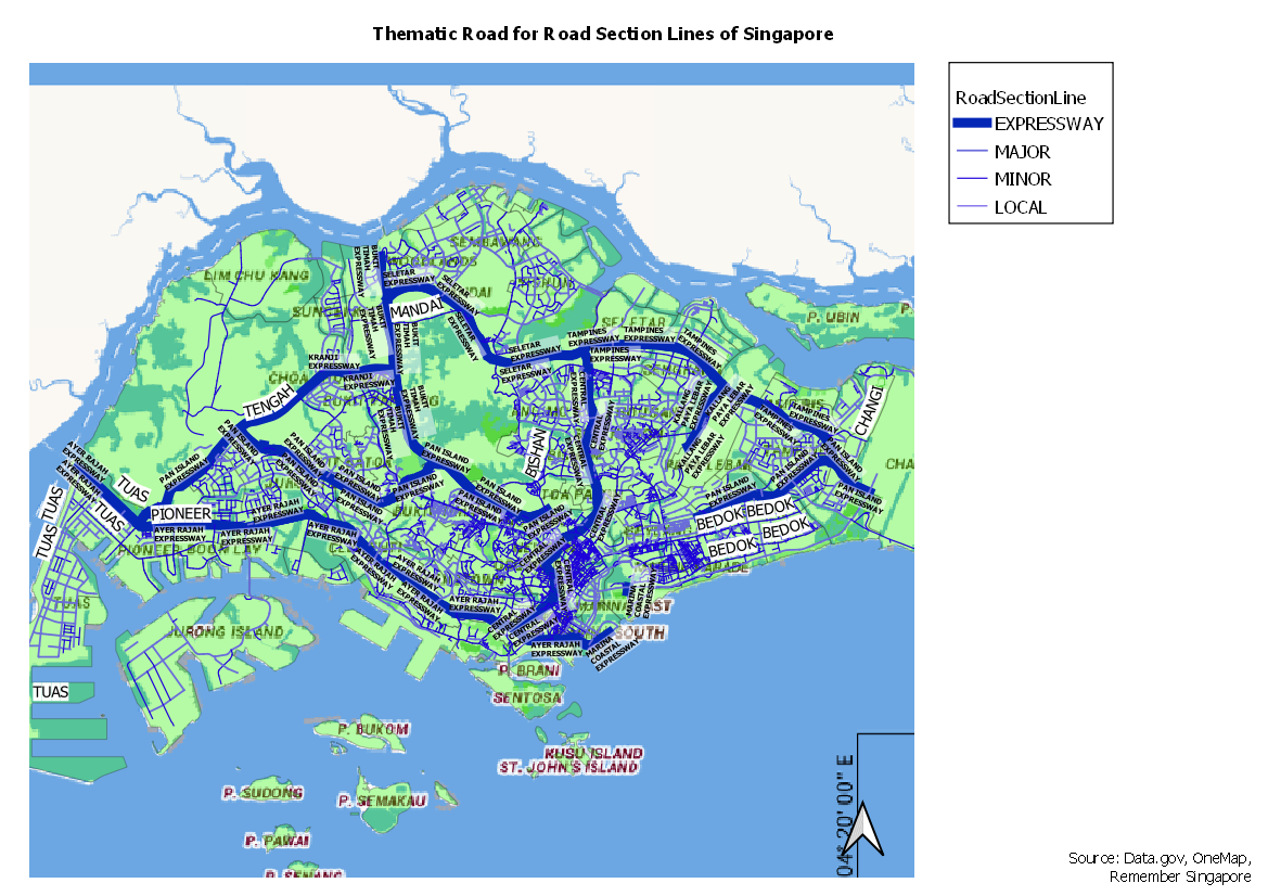
Road Section Line
Road Section Lines are represented with Categorized Symbology as well. However, the type of roads are categorized with various width instead of difference in color, with Expressways having the thickest width.
Distribution of School by Type in Singapore


