G2-Group15 Proposal
| ABOUT | PROPOSAL | POSTER | WEB MAPS | REPORT |
|---|
| PROJECT MOTIVATION |
|---|
|
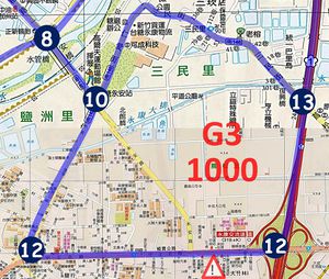
Nothing is 台南 originates as a Business Profiling Project from the SMT201-Geographical Information Systems (GIS) for Urban Planning module supported by Professor Kam Tin Seong from the School of Information Systems, Singapore Management University, involving data received from an International Food & Beverage franchise (referred to as the 'Client') present in Taiwan. Our Client has compiled their trade areas in the form of sketch-maps in PowerPoint format. These sketch-maps display their sub-trading areas, trading routes and competitors existing in that trade area. However, with these sketch-maps being static in nature of its format, the Client has limitations when using such maps for updates and analysis which are not limited to the following:
Hence, our team saw this not only as an opportunity to assist our client, but also to utilize our skills and knowledge gained from the module to real-world applications to better hone them. Our role involves the transformation of these PowerPoint sketch-maps into proper and purposeful web maps using the GIS Software QGIS, allowing our Client to not only have a complete view of their trade areas and sales territories, bringing the Client new insights on their trade areas. Some of the insights include factors and Points of Interests (POIs) that can be affect its sales in their trade areas. |
| PROJECT OBJECTIVE |
|---|
|
Nothing is 台南 aims to fulfill the following project objectives:
|
| SCOPE OF WORK |
|---|
|
Our team was allocated a total of 16 Client stores based on Taiwan, in which all these stores are based in the Southwest coast of Taiwan, specifically the county of Tainan City. The 16 stores assigned to our team are:
With our allocated stores all within the same county and most of it in close proximity, we will be identifying any trends and patterns with regards to the location of the stores and their profit performance. We will also be recommending any changes in the location of the stores to possibly improve the profit performance of a re-located trade area without internal competition among our client's stores for sales. Moreover, if there are trade areas (we will refer to them as Blanks) that do not belong to any of our allocated stores, we would also be recommending on the best possible allocated store that should include these blanks based on the store's profit performance. |
| DATA |
|---|
| PROJECT SCHEDULE |
|---|
| REFERENCES |
|---|


