G1-Group06 Report
Revision as of 13:41, 20 October 2019 by Huiyun.lee.2018 (talk | contribs) (→Land Use (Overlay of 2008 & 2014))
|
|
|
|
|
|
Contents
Yishun's Brief Overview
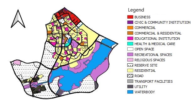
2008 LandUse
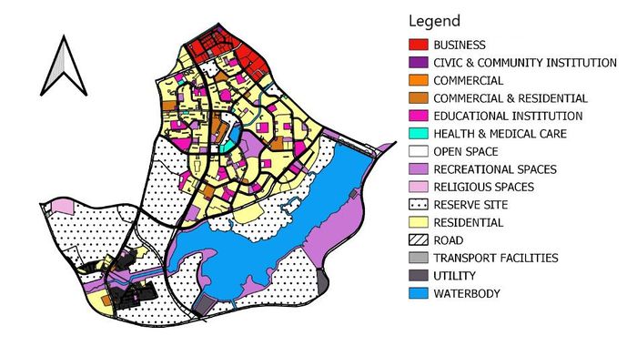
2014 LandUse
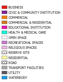
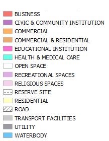
Number of Things in Legend (15)
- BUSINESS (BUSINESS 1/BUSINESS 2)
- CIVIC & COMMUNITY INSTITUTION
- COMMERCIAL
- COMMERCIAL & RESIDENTIAL (COMMERCIAL & RESIDENTIAL/RESIDENTIAL WITH COMMERCIAL AT 1 ST STOREY)
- EDUCATIONAL INSTITUTION
- HEALTH & MEDICAL CARE
- OPEN SPACE
- RECREATIONAL SPACES (PARK/SPORT & RECREATION)
- RELIGIOUS SPACES (CEMETERY/PLACE OF WORSHIP)
- RESERVE SITE (RESERVE SITE/SPECIAL USE)
- RESIDENTIAL
- ROAD
- TRANSPORT FACILITIES (MASS RAPID TRANSIT/TRANSPORT FACILITIES)
- UTILITY
- WATERBODY
For the legend, Our group had decided to combine some of the features as it is under the same categories. Furthermore, by minimizing the legend would make it more meaningful and easy to understand.
Change Detection
Macro Changes
Planning area
| 2008 & 2014 Planning area |
|---|
|
|
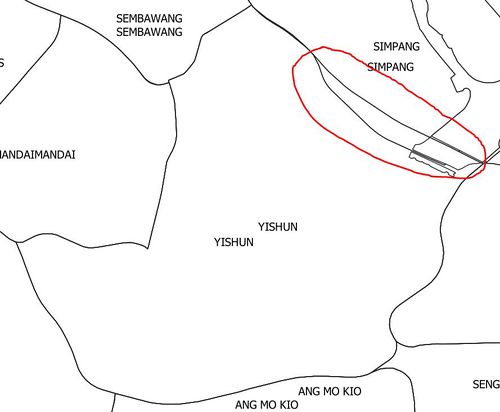
The planning area of Yishun has reduced in 2014 from 2008. As seen in both of the maps in the table above, the planning area of Yishun has reduced inwards and given to Simpang.
Land Use (Overlay of 2008 & 2014)
| 2008 Legend | 2014 Legend |
|---|---|
| Facilities | No. of Attributes 2008 | No. of Attributes 2014 | Change in No. of Attributes from 2008-2014
|
|---|---|---|---|
| BUSINESS
|
|
|
|
| CIVIC & COMMUNITY INSTITUTION
|
|
|
|
| COMMERCIAL
|
|
|
|
| COMMERCIAL & RESIDENTIAL
|
|
|
|
| EDUCATION INSTITUTION
|
|
|
|
| HEALTH & MEDICAL CARE
|
|
|
|
| OPEN SPACE
|
|
|
|
| RECREATIONAL SPACES
|
|
|
|
| RELIGIOUS SPACES
|
|
|
|
| RESERVE SITE
|
|
|
|
| RESIDENTIAL
|
|
| |
| ROAD
|
|
|
|
| TRANSPORT FACILITIES
|
|
|
|
| UTILITY
|
|
|
|
| WATERBODY
|
|
|
|
Micro Changes
| 2008 | 2014 |
|---|---|
|
|
