G1-Group02
Contents
Proposal
Project Motivation
Project Objective
About Serangoon
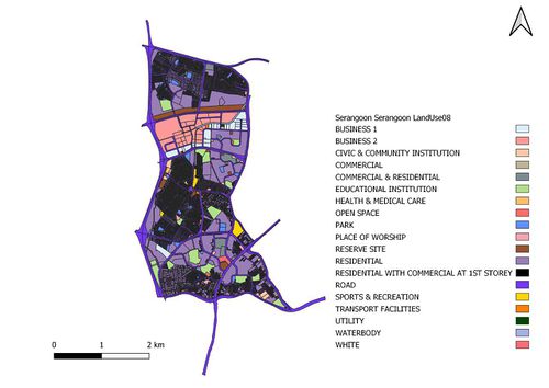
Serangoon is named after a bird commonly found in the riverine swamps around the Serangoon River and is located in the central part of Singapore, within the North-eastern region. It mainly consists of residential buildings with a total land area of 10.1km² and total population size of 116,310 as of June 2019. The area attracted more people after Nex, a shopping mall connected to a bus interchange, and the Serangoon Circle Line MRT station were built in 2010.
Data Source
| Data Name | Data Format | Source | |
|---|---|---|---|
| Landuse (2008/2014/2019) | |||
| URA Planning Areas (2008) | Shape files | https://data.gov.sg/dataset/master-plan-2008-planning-area-boundary-no-sea | |
| URA Planning Areas (2014) | Shape files | https://data.gov.sg/dataset/master-plan-2014-planning-area-boundary-web | |
| URA Planning Areas (2019) | Reference | https://www.ura.gov.sg/Corporate/Planning/Draft-Master-Plan-19 | |
| Population | |||
| Population (2015) | CSV | https://www.singstat.gov.sg/find-data/search-by-theme/population/geographic-distribution/latest-data | |
| Population (2019) | CSV | https://www.singstat.gov.sg/-/media/files/publications/population/population2019.pdf | |
| Profession | CSV | https://www.tablebuilder.singstat.gov.sg/publicfacing/createSpecialTable.action?refId=8321 | |
| Education & Healthcare Services | |||
| Childcare Services | Shapefile | https://data.gov.sg/dataset/listing-of-centres | |
