File:Road Network (Close Up).png
Revision as of 00:27, 16 September 2019 by Mabelletham.2018 (talk | contribs) (For this map, I chose contrasting, distinct, bright colours for the roads as seen from the 1cm thick bright yellow for Expressway, 0.5cm thick dark blue for Major Road and 0.25cm thin bright orange line for minor roads. For enhanced and clearer visuali...)

Size of this preview: 800 × 566 pixels. Other resolutions: 320 × 226 pixels | 1,681 × 1,189 pixels.
Original file (1,681 × 1,189 pixels, file size: 1.73 MB, MIME type: image/png)
Summary
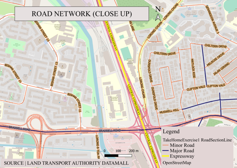
For this map, I chose contrasting, distinct, bright colours for the roads as seen from the 1cm thick bright yellow for Expressway, 0.5cm thick dark blue for Major Road and 0.25cm thin bright orange line for minor roads. For enhanced and clearer visualization, I applied the buffer for each label, ensuring the words will be easy to read.
File history
Click on a date/time to view the file as it appeared at that time.
| Date/Time | Thumbnail | Dimensions | User | Comment | |
|---|---|---|---|---|---|
| current | 00:27, 16 September 2019 | | 1,681 × 1,189 (1.73 MB) | Mabelletham.2018 (talk | contribs) | For this map, I chose contrasting, distinct, bright colours for the roads as seen from the 1cm thick bright yellow for Expressway, 0.5cm thick dark blue for Major Road and 0.25cm thin bright orange line for minor roads. For enhanced and clearer visuali... |
- You cannot overwrite this file.
File usage
The following page links to this file:
.png&oldid=3503)
.png)
.png&action=edit&redlink=1)
.png&action=edit)
.png&action=history)
.png)
.png)
.png&oldid=3503)
.png&action=info)