SMT201 AY2019-20G2 EX1 Siti Salihah Binte Mohamed Rilvan
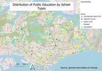
Revision as of 21:44, 15 September 2019 by Salihahmr.2018 (talk | contribs) (When it comes to classification, I used mainlevel_ category to classify as the column contains details such as secondary, primary etc. As such, we can see how the different type of schools are distributed throughout Singapore. To facilitate reading where)
