SMT201 AY2019-20G2 EX1 FAN YIXI
Part 1: Thematic Mapping
Distribution of Public Education Institution in Singapore
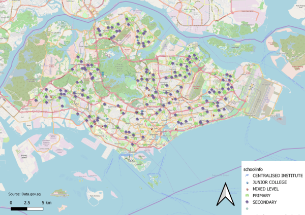
To depic the distribution of public education institution, I made use of the school information layer where the various institutions are categorized by school types.
Each school type is assigned to a specific SVG marker. I decided to use different markers such as books, location pin etc. for each school type in order to differentiate the different institutions.
I decided to use OSM instead of coastal outline for my background as it makes it clearer to the viewer, the institution options available in each subzones.
Hierarchy of Road Network Systemm in Singapore
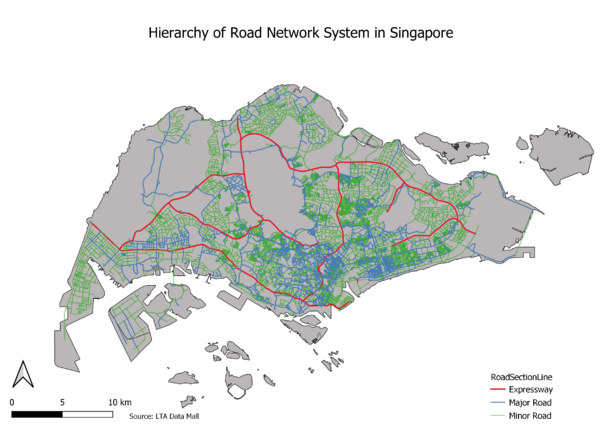
This map shows the hierarchy of road network system in Singapore, classified under 3 main categories, expressway, major road and minor roads.
Making use of the GIS data from LTA, it allows us to separate the roads into the categories by using the RD_TYPE variable.
To highlight the hierarchy, the expressway lines are made thicker, followed by major road and minor road being the thinnest.

