SMT201 AY2019-20T1 EX1 Tan Wei Long Ryan
Contents
- 1 Part One: Thematic Mapping
- 2 Part Two: Choropleth Mapping
- 2.1 Singapore's Aged Population (65+) in 2010
- 2.2 Singapore's Aged Population (65+) in 2018
- 2.3 Proportion of Singapore's Aged Population in 2010
- 2.4 Proportion of Singapore's Aged Population in 2018
- 2.5 Percentage Change of Aged Population From 2010 to 2018
- 2.6 Reasoning behind classification choices
- 3 References and data sources
Part One: Thematic Mapping
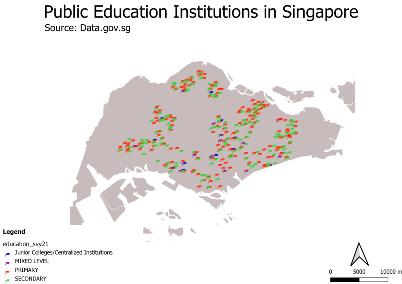
Distribution of Public Education Institutions in Singapore
The map shown is a qualitative thematic map with point symbols.
The different public education institutions are symbolized by classifying them based on the institution’s education level, namely Junior College/Centralized Institutions, Mixed Level, Primary and Secondary and plotted on the coastal outline of Singapore.
A light grey fill is chosen for the coastal outline which allows the symbols on the map to stand out with their respective colours, allowing readers to easily see the distribution of the schools across the island.
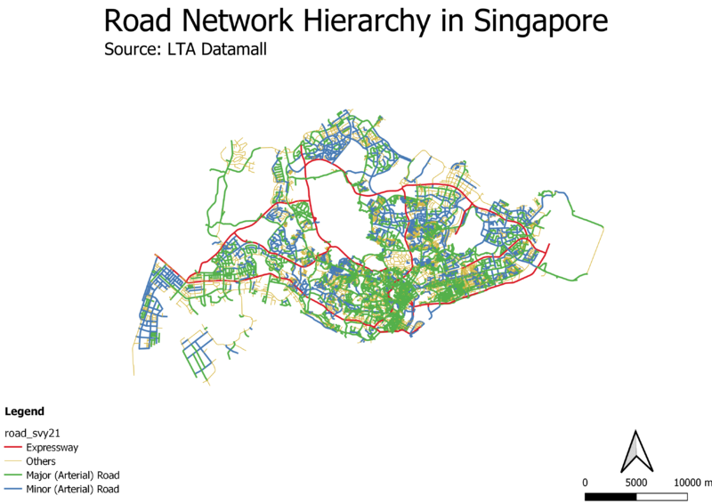
Hierarchy of Road Network System in Singapore
xxxx aa12321
2014 Master Plan Landuse
xxxx this xxxx
Part Two: Choropleth Mapping
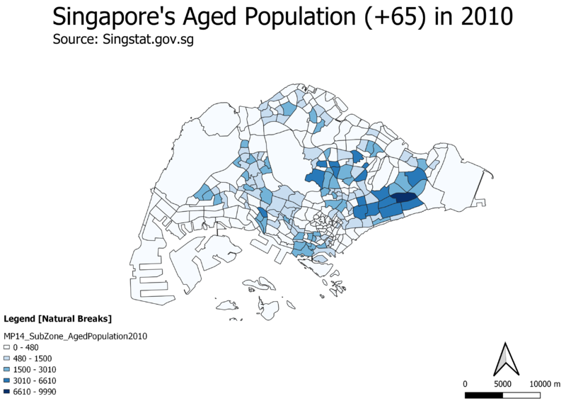
Singapore's Aged Population (65+) in 2010
xxxxx
Singapore's Aged Population (65+) in 2018
xxx
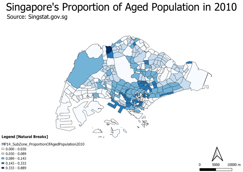
Proportion of Singapore's Aged Population in 2010
123
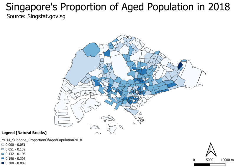
Proportion of Singapore's Aged Population in 2018
123213
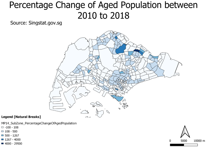
Percentage Change of Aged Population From 2010 to 2018
123213
Reasoning behind classification choices
123321
References and data sources
1. https://www.data.gov.sg/search?q=school+information
2. https://www.data.gov.sg/dataset/master-plan-2014-land-use
3. https://www.data.gov.sg/dataset/master-plan-2014-subzone-boundary-no-sea
4. https://www.lta.gov.sg/content/ltaweb/en/industry-matters/sale-of-plans-and-information/road-line-plan/road-line-plan-explanatory-notes.html
5. https://remembersingapore.org/2018/08/15/singapore-street-suffixes/
6. SMT201 elearn - Week 4 Hands on Ex 4 - Coastal Outline Shapefiles from SLA
7. https://www.mytransport.sg/content/mytransport/home/dataMall/search_datasets.html?searchText=road - Road Selection Line
