File:School Institutions .jpg
Revision as of 16:44, 15 September 2019 by Sqseah.2018 (talk | contribs)

Size of this preview: 800 × 566 pixels. Other resolutions: 320 × 226 pixels | 1,280 × 905 pixels.
Original file (1,280 × 905 pixels, file size: 310 KB, MIME type: image/jpeg)
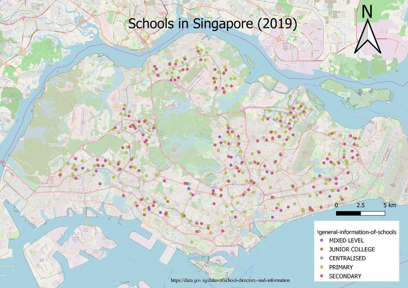
The map above shows the distribution of the different levels of schools across Singapore, which allows us to better see the concentration of different levels of schools in which areas. From the map above, we see that primary schools are the most prevalent and are evenly distributed across Singapore. In the North and West areas, we see an evident lack of junior colleges. Finally, an open street map was added for better representation of the school distribution.
File history
Click on a date/time to view the file as it appeared at that time.
| Date/Time | Thumbnail | Dimensions | User | Comment | |
|---|---|---|---|---|---|
| current | 16:44, 15 September 2019 | | 1,280 × 905 (310 KB) | Sqseah.2018 (talk | contribs) |
- You cannot overwrite this file.
File usage
There are no pages that use this file.