SMT201 AY2019-20G2 Ex1 Soh Bai He

From Geospatial Analytics for Urban Planning
Revision as of 16:10, 15 September 2019 by Baihe.soh.2018 (talk | contribs)
Jump to navigation Jump to search

Part One: Thematic Mapping

Public Education Institutions


Data Source: data.gov.sg / File: general-information-of-schools.csv

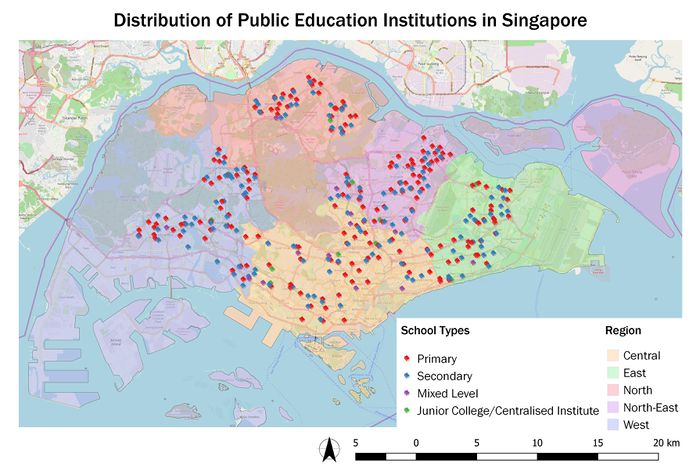
Feature count: Total (344), Primary (181), Secondary (138), Mixed Level (14), Junior College/Centralised Institute (11)
Choice of Classification: Categorisation by school type. Junior College and Centralised Institute are grouped together as both offers pre-university courses and lead to the ‘A’ Level examinations.
Visual Variable: An SVG marker of a book is used as the symbol. Different colours are used for each school type to for easier identification.
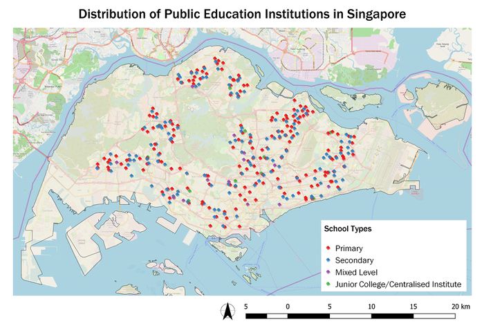
P1a-schooldistributionbyregion.jpg

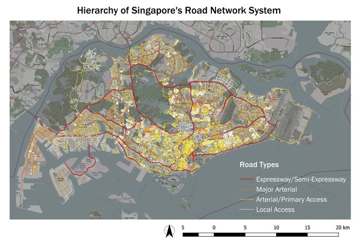
Road Network System

Data Source: mytransport.sg / File: RoadSectionLine.shp

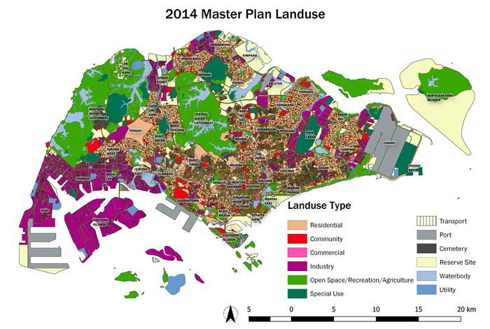
2014 Master Plan Landuse

Data Source: data.gov.sg / File: G_MP14_LAND_USE_PL.shp

Part Two: Choropleth Mapping

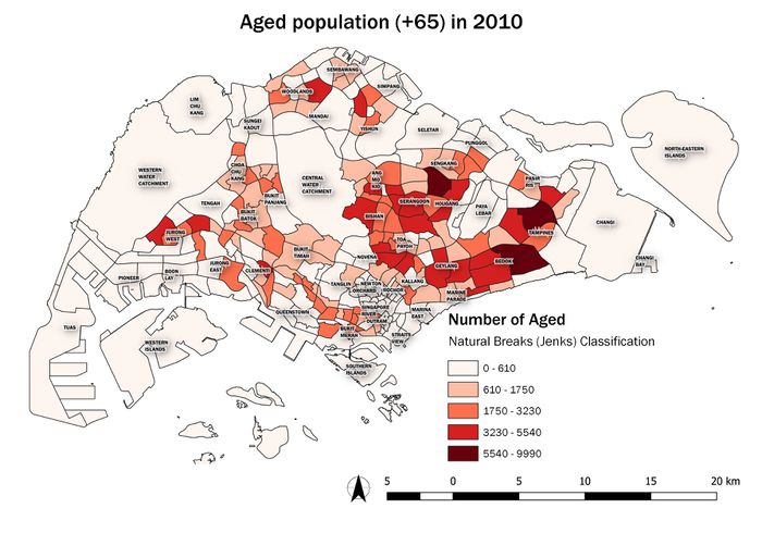
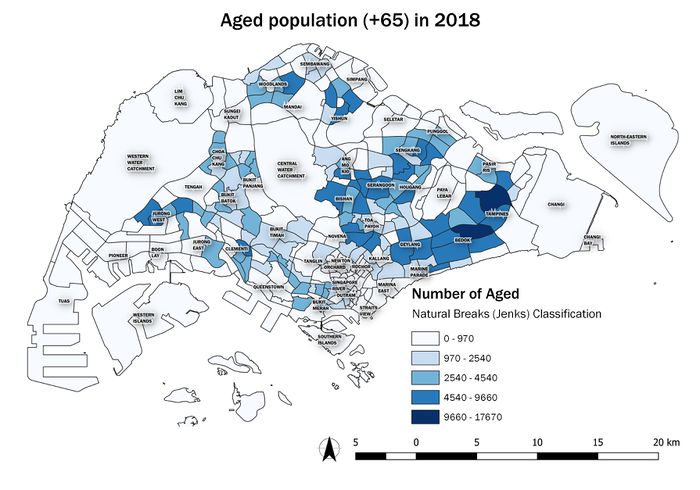
Aged population (+65) in 2010 and 2018

Data Source: data.gov.sg / File: SUBZONE_AGE_GENDER_2010.shp
Data Source: singstat.gov.sg / File: SGResidentPopulationAgeGroupSex_2018.csv

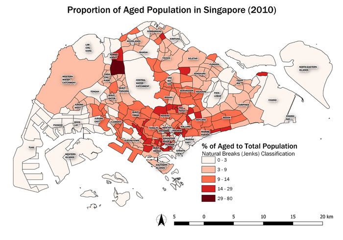
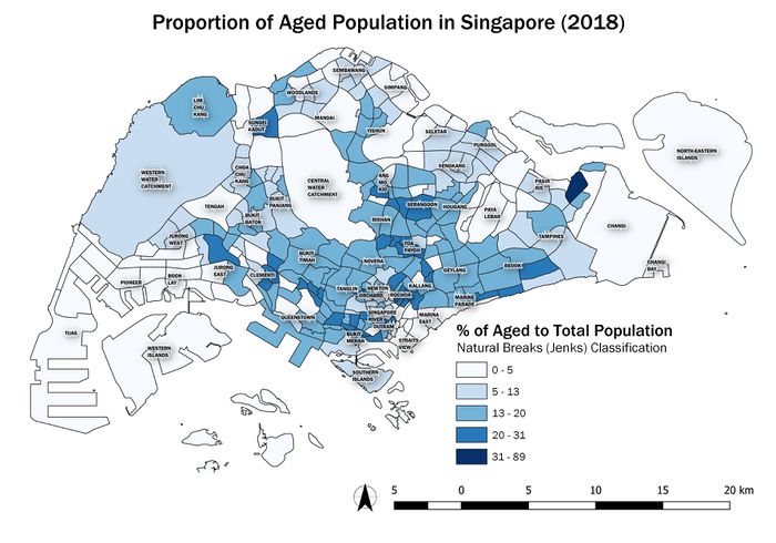
Proportional of aged population in 2010 and 2018

P2b-2010.jpg
P2b-2018.jpg

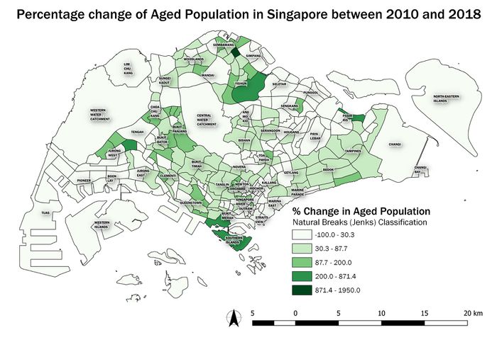
Percentage change of aged population between 2010 and 2018

P2c.jpg

References & Acknowledgements