File:Gantz chart G1 T9 Punggol.JPG
Revision as of 18:33, 24 November 2019 by Xunjie.ng.2018 (talk | contribs)
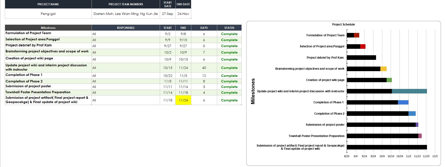
Size of this preview: 800 × 300 pixels. Other resolutions: 320 × 120 pixels | 1,852 × 695 pixels.
Original file (1,852 × 695 pixels, file size: 160 KB, MIME type: image/jpeg)
File history
Click on a date/time to view the file as it appeared at that time.
| Date/Time | Thumbnail | Dimensions | User | Comment | |
|---|---|---|---|---|---|
| current | 18:33, 24 November 2019 | 1,852 × 695 (160 KB) | Xunjie.ng.2018 (talk | contribs) |
- You cannot overwrite this file.
File usage
The following page links to this file: