G1-Group09 Web Maps

From Geospatial Analytics for Urban Planning
Revision as of 18:15, 23 November 2019 by Xunjie.ng.2018 (talk | contribs)
Jump to navigation Jump to search

HOME

PROPOSAL

POSTER

WEB MAPS

PROJECT REPORT

link

https://sphozbeo8wg5y5d5uxwbhg-on.drv.tw/GIS/qgis2web_2019_11_16_Economically_Active/#8/1.404/103.909

https://sphozbeo8wg5y5d5uxwbhg-on.drv.tw/GIS/Punggol_Landuse_Change_Detection_webmap/#8/1.405/103.909

https://sphozbeo8wg5y5d5uxwbhg-on.drv.tw/GIS/Library_Suitability/#8/1.406/103.911

https://sphozbeo8wg5y5d5uxwbhg-on.drv.tw/GIS/elderlycare%20centre%20suitability/#8/1.404/103.909


Land suitability library young Punggol.jpg
Figure 1. Land suitability for construction of a library in Punggol for the young (Age 0 to 4)
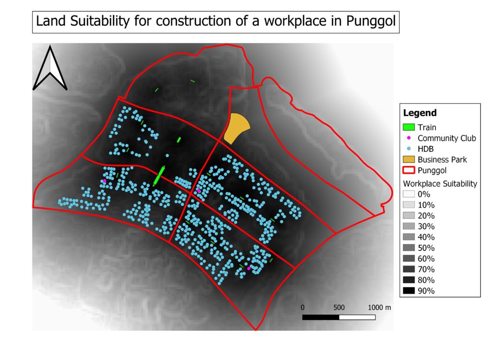
Land suitabbility workplace econActive Punggol.png
Figure 2. Land suitability for construction of a workspace in Punggol for the Economically Active (Age 15 to 64)


Land suitability eldercare elderly Punggol.jpg
Figure 3. Land suitability for construction of Elderlycare in Punggol for the elderly(Age 65 and above)
  • LanduseChange detection Punggol.jpg
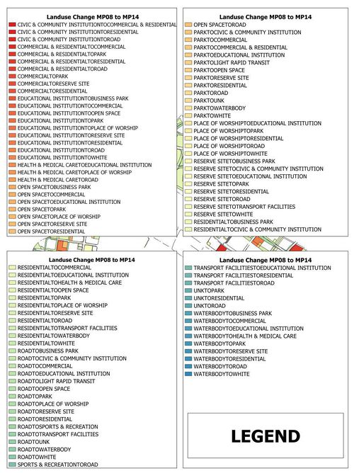
  • LanduseChange detection Legend Punggol.jpg
  • Figure 3. Land Use Change Detection for Punggol (MP08 to MP14)