Uncategorised files
Jump to navigation
Jump to search
Showing below up to 50 results in range #1,601 to #1,650.
View (previous 50 | next 50) (20 | 50 | 100 | 250 | 500)
 NewProximity.png 3,507 × 2,716; 1.02 MB
 NewTaipeiLogo(G1-15).png 425 × 425; 168 KB
 NewTaipeiLogo2(G1Group15).png 418 × 357; 181 KB
 New 2010 Aged65+ Population.jpeg 3,507 × 2,480; 464 KB
 New 2010 Aged65+ Population.jpg 3,507 × 2,480; 464 KB
 New 2010 Proportion Aged65+.jpg 3,507 × 2,480; 456 KB
 New 2014 Master Plan Landuse.jpg 3,507 × 2,480; 865 KB
 New 2018 Population Aged65+.jpeg 3,507 × 2,480; 466 KB
 New 2018 Population Aged65+.jpg 3,507 × 2,480; 466 KB
 New 2018 Proportion Aged65+.jpeg 3,507 × 2,480; 461 KB
 New 2018 Proportion Aged65+.jpg 3,507 × 2,480; 461 KB
 New Aaron 2010 Aged65+ Pop.jpeg 3,507 × 2,480; 464 KB
 New Aaron 2010 Aged65+ Population.jpeg 3,507 × 2,480; 464 KB
 New Percentage Change From 2010 to 2018.jpg 3,507 × 2,480; 466 KB
 New Public Education Institution.jpg 3,507 × 2,480; 557 KB
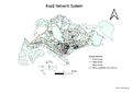 New Road Network System.jpg 3,507 × 2,480; 631 KB
 New part three leandra.png 3,507 × 2,480; 1.13 MB
 New proximities v2 leandra.png 3,507 × 2,480; 1.15 MB
 Newtaipei.png 851 × 709; 598 KB
 NigelAgedPopulation2010.png 3,507 × 2,480; 1.4 MB
 NigelAgedPopulation2018.png 3,507 × 2,480; 1.43 MB
 NigelAgedPopulationChange.png 3,507 × 2,480; 1.21 MB
 NigelAgedProportion2010.png 3,507 × 2,480; 1.48 MB
 NigelAgedProportion2018.png 3,507 × 2,480; 1.41 MB
 NigelLandUse.png 3,507 × 2,480; 1.83 MB
 NigelRoadTheme.png 3,507 × 2,480; 1.35 MB
 NigelSchool.png 3,507 × 2,480; 1.28 MB
 Nigel AHP Values.PNG 849 × 161; 9 KB
 Nigel AHP Values.jpg 849 × 161; 29 KB
 Nigel AHP calculation.PNG 549 × 477; 18 KB
 Nigel AHP calculation.jpg 549 × 477; 36 KB
 Nigel Poly suit.png 3,507 × 2,480; 66 KB
 Nigel Raster suit.png 3,507 × 2,480; 418 KB
 Nigel Size.PNG 1,354 × 774; 32 KB
 Nigel zScore.PNG 405 × 120; 22 KB
 Nigel zScore.jpg 405 × 120; 4 KB
 NogadaFinal.png 776 × 546; 78 KB
 Normal1.png 3,507 × 3,129; 1.37 MB
 Normal2.png 3,507 × 3,129; 1.33 MB
 Normal3.png 3,507 × 3,129; 1.33 MB
 Normalisationformula.png 458 × 214; 26 KB
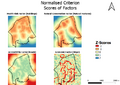 Normalised Criterion Maps.png 813 × 573; 180 KB
 Normalised Roads.png 1,215 × 685; 79 KB
 Northshore forecast.jpg 2,427 × 598; 112 KB
 Northshore pop.jpg 1,345 × 937; 81 KB
 Northshore pop graph.jpg 1,199 × 745; 57 KB
 Number of Aged 65+ year 2010.jpg 3,507 × 2,480; 1.01 MB
 Numberelderly2010 kch.png 3,507 × 2,480; 827 KB
 Numberelderly2018 kch.png 3,507 × 2,480; 734 KB
 Official Executive Report Pic.jpg 1,909 × 2,000; 237 KB

.png)
.png)


