Uncategorised files
Jump to navigation
Jump to search
Showing below up to 50 results in range #1,391 to #1,440.
View (previous 50 | next 50) (20 | 50 | 100 | 250 | 500)
 M32014.jpg 710 × 587; 128 KB
 M3oo.jpg 1,039 × 863; 185 KB
 M3ovv.jpg 1,081 × 848; 184 KB
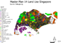
 MASTERPLAN2014LANDUSE.jpg 1,388 × 1,076; 362 KB
 MASTERPLAN 2014 LANDUSE.png 1,388 × 1,076; 1.22 MB
 MCA AHP Gombak.png 3,507 × 2,480; 267 KB
 MLR food and beverage and business.PNG 865 × 352; 22 KB
 MLR food and beverage and business 3.5km.PNG 862 × 361; 22 KB
 MLR food and beverage and business 3km buffer.PNG 842 × 373; 22 KB
 MLR food and beverage and business current TA.PNG 916 × 379; 23 KB
 MLR transportation education sports servicearea.PNG 667 × 389; 23 KB
 MP08 2010Proportion.png 3,507 × 2,480; 1.01 MB
 MP08 65+.png 3,507 × 2,480; 953 KB
 MP08 65 dion.png 3,507 × 2,480; 953 KB
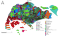
 MP14-Landuse.jpg 3,507 × 2,480; 905 KB
 MP14 2018Proportion.png 3,507 × 2,480; 1.08 MB
 MP14 65+.png 3,507 × 2,480; 1.12 MB
 MP14 65 dion.png 3,507 × 2,480; 1.12 MB
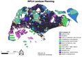
 MP14 LandUse.png 3,507 × 2,480; 1.87 MB
 MP14 Land Use (for wiki).png 1,411 × 866; 743 KB
 MP14 Landuse.jpg 1,784 × 1,246; 356 KB
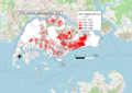 MP14 subzone aged population 2010.png 3,534 × 2,502; 1.41 MB
 MP14 subzone aged population 2018.png 3,507 × 2,480; 1.13 MB
 MP14 subzone aged population percentage change between 2010 and 2018.png 3,507 × 2,480; 1.38 MB
 MP14 subzone aged population proportion 2010.png 3,507 × 2,480; 1.27 MB
 MP14 subzone aged population proportion 2018.png 3,507 × 2,480; 1.19 MB
 MP2014.png 1,845 × 1,222; 887 KB
 MP 14 Land.png 800 × 566; 546 KB
 Mac.png 768 × 764; 123 KB
 Map1.jpg 1,280 × 720; 223 KB
 Map1 KrystalOng.JPG 782 × 552; 72 KB
 Map1 Updated.png 748 × 526; 91 KB
 Map1 edited scale.png 777 × 650; 227 KB
 Map1 haonan v3.png 1,199 × 897; 445 KB
 Map1 klh.png 1,329 × 937; 200 KB
 Map1 school.png 1,080 × 763; 684 KB
 Map1 schools zoomed out.png 1,169 × 826; 450 KB
 Map1 takehome2 haonan.png 1,179 × 884; 426 KB
 Map1 takehome2 haonan v2.png 1,131 × 880; 423 KB
 Map1 takehome luohaonan v2.png 1,195 × 881; 444 KB
 Map1 twy.jpg 1,280 × 1,280; 107 KB
 Map2.png 4,000 × 2,828; 1.2 MB
 Map2010.jpg 3,507 × 2,480; 1.12 MB
 Map2018.jpg 3,507 × 2,480; 1.1 MB
 Map2 KrystalOng.jpg 1,061 × 712; 159 KB
 Map2 Krystal Ong.jpg 1,280 × 720; 141 KB
 Map2 haonan V1.png 1,168 × 883; 763 KB
 Map2 klh.png 1,116 × 782; 317 KB
 Map2 roads.png 1,080 × 763; 516 KB
 Map2 roads zoomed out.png 1,169 × 826; 407 KB


.png)


