SMT201 AY2019-20T1 EX2 Lee Wan Ning
Part 1: Input Layers
Objective
The report must provide the followings:
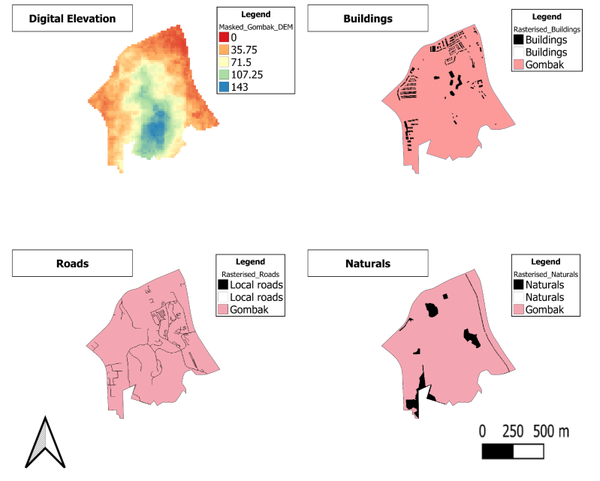
• A map layout with four views showing:
• the study area and the target roads,
• the study area and buildings,
• the study area and the target natural features,
• the study area and digital elevation, and
a short description of not more than 100 words for each view.
The digital elevation layer is in raster format, whereas the other layers are in vector format.
After importing all the data layers, i have subsequently used the "Clip" function under vector->geoprocessing tools to extract only the area of study, Gombak planning subzone for the vector layers. For the raster layer, i used "Clip Raster By Extent" under raster->extraction.
For the purpose of the analysis later on, i have rasterised all the vector layers.
Furthermore, i have categorised the digital elevation layer according to range of the elevation values(in metres) in the Gombak planning subzone.
For example, yellow shaded areaa on the digital elevation layer would mean that the land there is 71.5m above sea level.
