File:MapLayout1.png
Revision as of 18:40, 6 November 2019 by Eddie.leow.2017 (talk | contribs)
Size of this preview: 800 × 566 pixels. Other resolutions: 320 × 226 pixels | 3,507 × 2,480 pixels.
Original file (3,507 × 2,480 pixels, file size: 774 KB, MIME type: image/png)
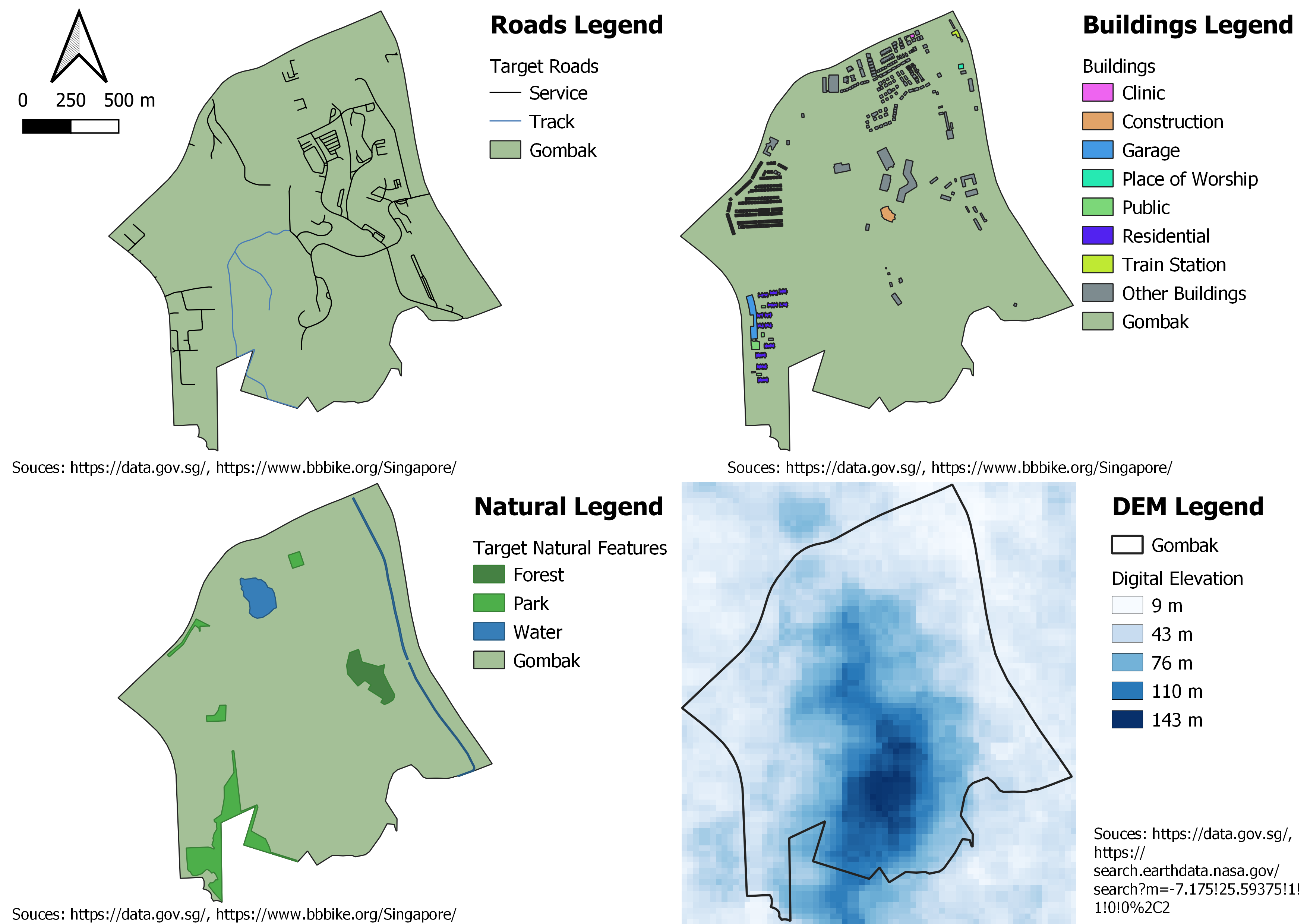
A map layout with four views showing Gombak and roads, Gombak and buildings, Gombak and natural features, and Gombak and digital elevation.
File history
Click on a date/time to view the file as it appeared at that time.
| Date/Time | Thumbnail | Dimensions | User | Comment | |
|---|---|---|---|---|---|
| current | 21:45, 6 November 2019 | | 3,507 × 2,480 (774 KB) | Eddie.leow.2017 (talk | contribs) | Capitalized legend for natural features and updated legend for DEM. |
| 21:38, 6 November 2019 |  | 3,507 × 2,480 (773 KB) | Eddie.leow.2017 (talk | contribs) | North arrow and map scale were out of range in previous version. Updated the position to keep it within the picture. | |
| 21:33, 6 November 2019 |  | 3,507 × 2,480 (756 KB) | Eddie.leow.2017 (talk | contribs) | Updated north arrow position, map scale position, remove all except target roads (service roads and tracks) and redo DEM due to wrong scale. | |
| 18:40, 6 November 2019 |  | 3,507 × 2,480 (874 KB) | Eddie.leow.2017 (talk | contribs) |
- You cannot overwrite this file.
File usage
The following page links to this file: